


<< Our Photo Pages >> Museum Neubrandenburg - Museum in Germany in Mecklenburg-Western Pomerania
Submitted by Boeddel on Wednesday, 08 April 2015 Page Views: 1168
MuseumsSite Name: Museum NeubrandenburgCountry: Germany
NOTE: This site is 0.404 km away from the location you searched for.
Land: Mecklenburg-Western Pomerania Type: Museum
Latitude: 53.557016N Longitude: 13.254991E
Condition:
| 5 | Perfect |
| 4 | Almost Perfect |
| 3 | Reasonable but with some damage |
| 2 | Ruined but still recognisable as an ancient site |
| 1 | Pretty much destroyed, possibly visible as crop marks |
| 0 | No data. |
| -1 | Completely destroyed |
| 5 | Superb |
| 4 | Good |
| 3 | Ordinary |
| 2 | Not Good |
| 1 | Awful |
| 0 | No data. |
| 5 | Can be driven to, probably with disabled access |
| 4 | Short walk on a footpath |
| 3 | Requiring a bit more of a walk |
| 2 | A long walk |
| 1 | In the middle of nowhere, a nightmare to find |
| 0 | No data. |
| 5 | co-ordinates taken by GPS or official recorded co-ordinates |
| 4 | co-ordinates scaled from a detailed map |
| 3 | co-ordinates scaled from a bad map |
| 2 | co-ordinates of the nearest village |
| 1 | co-ordinates of the nearest town |
| 0 | no data |
Internal Links:
External Links:
I have visited· I would like to visit
Boeddel visited on 1st Jan 2012 - their rating: Access: 4
")
Ausstellung zur Ur- & Frühgeschichte
Address: Treptower Straße 38 /
17033 Neubrandenburg /
Deutschland
Official Web Site
You may be viewing yesterday's version of this page. To see the most up to date information please register for a free account.
")
")
")
")
Do not use the above information on other web sites or publications without permission of the contributor.
Nearby Images from Flickr
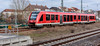
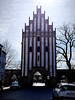
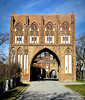
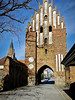
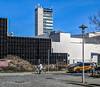
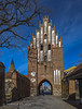
The above images may not be of the site on this page, but were taken nearby. They are loaded from Flickr so please click on them for image credits.
Click here to see more info for this site
Nearby sites
Click here to view sites on an interactive map of the areaKey: Red: member's photo, Blue: 3rd party photo, Yellow: other image, Green: no photo - please go there and take one, Grey: site destroyed
Download sites to:
KML (Google Earth)
GPX (GPS waypoints)
CSV (Garmin/Navman)
CSV (Excel)
To unlock full downloads you need to sign up as a Contributory Member. Otherwise downloads are limited to 50 sites.
Turn off the page maps and other distractions
Nearby sites listing. In the following links * = Image available
1.1km S 188° Steinkisten Kulturpark* Cist
4.1km NNW 327° Riesenstein Krappmühle* Rock Art
4.3km SSW 196° Großsteingrab Neubrandenburg* Burial Chamber or Dolmen
4.3km ENE 65° Ravensburg Neubrandenburg Ancient Village or Settlement
4.7km SE 141° Grosser Stein Neubrandenburg Rock Art
7.5km NNE 32° Schalenstein Neverin 1 Rock Art
7.5km WNW 283° De groote Stein Chemnitz Natural Stone / Erratic / Other Natural Feature
7.6km NNE 33° Schalenstein Neverin 2 Rock Art
9.0km W 260° Slawendorf Passentin* Museum
9.7km WSW 237° Tempelberg Krukow* Stone Circle
9.8km SW 225° Hügelgrab Alt Rehse* Round Barrow(s)
10.2km NNE 25° Schalenstein Hohenmin Rock Art
10.6km SW 215° Fischerinsel Wustrow Ancient Village or Settlement
11.0km SW 224° Hügelgrab Siehdichum Round Barrow(s)
11.4km SW 218° Wustrow Hügelgrab* Round Barrow(s)
12.1km NNE 19° Hügelgrab Ganzkow 6* Round Barrow(s)
12.3km SW 216° Schalenstein Zippelow 2 Rock Art
12.4km SW 216° Schalenstein Zippelow 1 Rock Art
13.0km SSW 210° Bacherswall Ancient Village or Settlement
13.3km NE 40° Roggenhagen (1)* Chambered Tomb
13.3km NE 40° Roggenhagen (2)* Chambered Tomb
15.2km NW 313° Kastorfer See Burgwall III* Hillfort
15.3km NW 315° Kastorfer See Burgwall I* Ancient Village or Settlement
15.5km NW 314° Kastorfer See kleiner Burgwall II Ancient Village or Settlement
15.8km N 359° Grosser Stein Altentreptow* Natural Stone / Erratic / Other Natural Feature
View more nearby sites and additional images

