Grid reference SE000560
3 km from Embsay, North Yorkshire, England
Coverage
We have 11 images in grid square SE0056
Contribute
Explore centiquare SE000560
Explore gridsquare SE0056
Surrounding area
Maps
 Map © Crown Copyright")
TIP: Click the map for more Large scale mapping
Tip: Click the map to open the coverage map
We have 11 images for SE0056
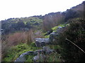 |
Stone Ridge Quarries
by Mick Borroff
The relatively shallow disused gritstone quarries have only left a minor scar on the moor.
|
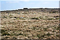 |
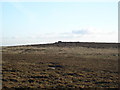
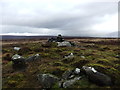
An unnamed top near Stone Ridge Plain
by Ian Greig
|
 |
Path on Embsay Moor
by Chris Heaton
Permissive path that leads north from Embsay to climb up onto Barden Moor, seen here on Stone Ridge. It is faint on the ground in places, but easy enough to follow without getting lost on this large expanse of wilderness.
|
 |
Shelter from the wind above Lumb Gill Head
by John Slater
|
 |
The peak of Bilton Ings
by Tim Cook
Bilton Ings is 433m above sea level
|
 |
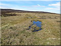
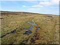
Tributary to Waterfall Gill draining Bilton Ings
by Mick Borroff
Taken on a misty, moisty afternoon.
|
 |
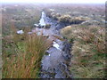
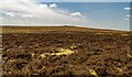
Soggy Path on Bilton Ings
by Chris Heaton
The path from Embsay onto Barden Moor hits a wet patch on Bilton Ings
|
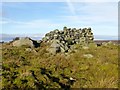 |
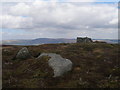
A Wall Shelter
by Rude Health
A wall shelter beside a rocky high point at 433 metres which is 2 metres lower than the nearby Brown Bank.
|
 |
Pile of stones on Brown Bank
by David Brown
|
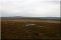 |
Near Bilton Ings
Heading for Brown Bank
|
 |
Stone Ridge Plain |
|