Grid reference SU811821
near to Cockpole Green, Wokingham, England
Coverage
We have 12 images in grid square SU8182
Contribute
Explore centiquare SU811821
Explore gridsquare SU8182
Surrounding area
Maps
 Map © Crown Copyright")
TIP: Click the map for more Large scale mapping
Tip: Click the map to open the coverage map
We have 12 images for SU8182
 |
Horses' paddock above Hurley
by Andrew Smith
Looking eastwards across the grid square
|
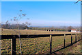 |
A Sloping Paddock near Hurley
The land is dropping down towards the Thames a short way north of here. The western third of this square is mostly horse paddock apart from a few trees.
|
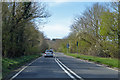 |
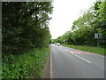
A4130 Henley Road
Heading west to Henley-on-Thames from Maidenhead.
|
 |
The Black Boy Inn
by James Emmans
Pub is viewed from bridleway across the road.
|
 |
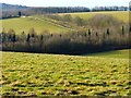
Dry valley and a strip of trees
by Andrew Smith
Looking north from the southern extremity of the grid square
|
 |
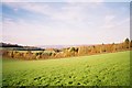
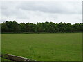
Rolling countryside, Hurley
by Andrew Smith
Low chalk hills rise to the south of the Thames between Cookham and Wargrave. A large area of these to the southwest of Hurley is occupied by Juddmonte Farms who breed horses. These are amongst their fields.
|
 |
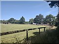
Pasture, Hurley
by Andrew Smith
Land grazed by the horses of Juddmonte Farms and some other livestock is viewed from a permitted footpath that crosses to Rose Lane.
|
 |
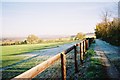
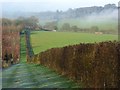
Bridleway near Hurley
The only public access to this square apart from a short bit of busy road. To the left it's horse paddocks, to the right is a large private estate.
|
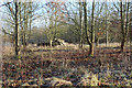 |
Woodland near Hurley
The eastern part of this square is a private estate, hidden from view behind a strip of woodland all the way along the bridleway. Not many photo opportunities.
|
 |
Dry valley near Hurley
Part of the rolling chalk landscape of the area between Henley and Maidenhead. The land here is part of Juddmonte stud farm, seen here looking north-west from Hodgedale Lane towards Rosehill.
|
 |
Grazing and woodland
by JThomas
Off Henley Road (A4130).
|
 |
Henley Road (A4130)
by JThomas
Towards Henley-on-Thames.
|
|