 with our Megalithic Portal iPhone app")


<< Our Photo Pages >> Badger's Well - Holy Well or Sacred Spring in England in Oxfordshire
Submitted by DavidCWoods on Monday, 18 September 2006 Page Views: 11092
Springs and Holy WellsSite Name: Badger's WellCountry: England County: Oxfordshire Type: Holy Well or Sacred Spring
Nearest Town: Oxford Nearest Village: Appleton
Map Ref: SP4360201485
Latitude: 51.710412N Longitude: 1.37035W
Condition:
| 5 | Perfect |
| 4 | Almost Perfect |
| 3 | Reasonable but with some damage |
| 2 | Ruined but still recognisable as an ancient site |
| 1 | Pretty much destroyed, possibly visible as crop marks |
| 0 | No data. |
| -1 | Completely destroyed |
| 5 | Superb |
| 4 | Good |
| 3 | Ordinary |
| 2 | Not Good |
| 1 | Awful |
| 0 | No data. |
| 5 | Can be driven to, probably with disabled access |
| 4 | Short walk on a footpath |
| 3 | Requiring a bit more of a walk |
| 2 | A long walk |
| 1 | In the middle of nowhere, a nightmare to find |
| 0 | No data. |
| 5 | co-ordinates taken by GPS or official recorded co-ordinates |
| 4 | co-ordinates scaled from a detailed map |
| 3 | co-ordinates scaled from a bad map |
| 2 | co-ordinates of the nearest village |
| 1 | co-ordinates of the nearest town |
| 0 | no data |
Internal Links:
External Links:
I have visited· I would like to visit
Harmudge visited on 26th May 2019 - their rating: Cond: 4 Amb: 4 Access: 4
")
Noted as traditionally a sovereign cure for eye ailments.
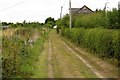
DavidCWoods writes... I visited in September 2006, and, after refreshing myself in The Plough in Appleton, took Badswell Lane (a couple of turnings north of the pub on the left). Although tarmaced for a hundred yards or so this quickly becomes a bridle path, with a very muddy patch soon afterwards. Having navigated past this the path narrows and, half a mile or so further on, the well may be seen on the right.
You may be viewing yesterday's version of this page. To see the most up to date information please register for a free account.
")
")
Do not use the above information on other web sites or publications without permission of the contributor.
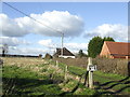
Nearby Images from Geograph Britain and Ireland:
©2012(licence)
©2007(licence)
©2013(licence)
©2015(licence)
©2016(licence)
The above images may not be of the site on this page, they are loaded from Geograph.
Please Submit an Image of this site or go out and take one for us!
Click here to see more info for this site
Nearby sites
Key: Red: member's photo, Blue: 3rd party photo, Yellow: other image, Green: no photo - please go there and take one, Grey: site destroyed
Download sites to:
KML (Google Earth)
GPX (GPS waypoints)
CSV (Garmin/Navman)
CSV (Excel)
To unlock full downloads you need to sign up as a Contributory Member. Otherwise downloads are limited to 50 sites.
Turn off the page maps and other distractions
Nearby sites listing. In the following links * = Image available
2.9km N 11° Physic Well (Cumnor)* Holy Well or Sacred Spring (SP4412604375)
3.2km W 269° Northmoor Linear Ditches* Barrow Cemetery (SP40390142)
4.1km NW 323° Devils Quoits* Stone Circle (SP41120476)
4.6km NNW 335° Stanton Harcourt Church Cross* Ancient Cross (SP4164305666)
5.1km NW 321° Gravelly Guy Timber Circle (SP404054)
5.3km S 175° Iron Age and Roman Complex at Frilford Ancient Village or Settlement (SU441962)
6.2km WNW 302° Standlake 20 Timber Circle (SP383047)
6.6km N 350° Deadman's Burial 1 Misc. Earthwork (SP42350795)
6.7km N 352° Deadman's Burial 2 Henge (SP42610807)
7.2km N 352° Eynsham Timber Circle Timber Circle (SP425086)
7.6km SE 131° Abingdon Cursus Cursus (SU494965)
8.1km SW 231° Cherbury Camp* Hillfort (SU374963)
8.2km NE 38° St Margaret's Well (Binsey)* Holy Well or Sacred Spring (SP486080)
8.6km SE 140° Drayton North Cursus Cursus (SU492950)
8.8km ESE 112° Barrow Hills Radley I Timber Circle (SU518983)
9.0km ENE 59° Museum of Oxford* Museum (SP513061)
9.0km NE 50° Walton Well* Holy Well or Sacred Spring (SP5047907312)
9.0km ENE 57° Ashmolean Museum of Art and Archaeology* Museum (SP511065)
9.1km SE 145° Drayton South Cursus Cursus (SU489941)
9.1km SE 144° Drayton North Cursus Cursus (SU490941)
9.3km NE 53° Radcliffe Infirmary prehistoric monumental landscape Round Barrow(s) (SP5103607101)
9.3km NE 55° Kendrew Quadrangle* Henge (SP51200695)
9.4km SSE 149° Drayton South Cursus Cursus (SU486935)
9.6km NE 56° Pitt Rivers Museum* Museum (SP51510695)
10.6km ENE 68° St Bartholomew's Well Holy Well or Sacred Spring (SP5349805476)
View more nearby sites and additional images

