


<< Text Pages >> Ardnadam - Chambered Cairn in Scotland in Argyll
Submitted by vicky on Monday, 04 November 2002 Page Views: 9053
Neolithic and Bronze AgeSite Name: Ardnadam Alternative Name: Adam's GraveCountry: Scotland
NOTE: This site is 3.319 km away from the location you searched for.
County: Argyll Type: Chambered Cairn
Map Ref: NS16188003 Landranger Map Number: 63
Latitude: 55.977949N Longitude: 4.947653W
Condition:
| 5 | Perfect |
| 4 | Almost Perfect |
| 3 | Reasonable but with some damage |
| 2 | Ruined but still recognisable as an ancient site |
| 1 | Pretty much destroyed, possibly visible as crop marks |
| 0 | No data. |
| -1 | Completely destroyed |
| 5 | Superb |
| 4 | Good |
| 3 | Ordinary |
| 2 | Not Good |
| 1 | Awful |
| 0 | No data. |
| 5 | Can be driven to, probably with disabled access |
| 4 | Short walk on a footpath |
| 3 | Requiring a bit more of a walk |
| 2 | A long walk |
| 1 | In the middle of nowhere, a nightmare to find |
| 0 | No data. |
| 5 | co-ordinates taken by GPS or official recorded co-ordinates |
| 4 | co-ordinates scaled from a detailed map |
| 3 | co-ordinates scaled from a bad map |
| 2 | co-ordinates of the nearest village |
| 1 | co-ordinates of the nearest town |
| 0 | no data |
Internal Links:
External Links:
I have visited· I would like to visit
SumDoood would like to visit
Canmore site no. 40774.
You may be viewing yesterday's version of this page. To see the most up to date information please register for a free account.
Do not use the above information on other web sites or publications without permission of the contributor.
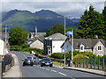
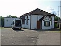
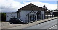
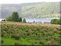
Nearby Images from Geograph Britain and Ireland:
©2019(licence)
©2009(licence)
©2019(licence)
©2017(licence)
©2019(licence)
The above images may not be of the site on this page, they are loaded from Geograph.
Please Submit an Image of this site or go out and take one for us!
Click here to see more info for this site
Nearby sites
Key: Red: member's photo, Blue: 3rd party photo, Yellow: other image, Green: no photo - please go there and take one, Grey: site destroyed
Download sites to:
KML (Google Earth)
GPX (GPS waypoints)
CSV (Garmin/Navman)
CSV (Excel)
To unlock full downloads you need to sign up as a Contributory Member. Otherwise downloads are limited to 50 sites.
Turn off the page maps and other distractions
Nearby sites listing. In the following links * = Image available
7.9km ESE 119° Larkfield Moor* Rock Art (NS22957591)
8.2km ESE 103° Granny Kempock Standing Stone* Standing Stone (Menhir) (NS2407877856)
8.6km S 186° Creag Bhreac Cairn* Cairn (NS1495571532)
10.4km ESE 115° Bunston Knowe* Modern Stone Circle etc (NS25457530)
10.9km SSE 147° Everton Cist Cist (NS2170070611)
11.4km WNW 291° Balliemore (Craigendive)* Standing Stones (NS0565084540)
11.5km SE 140° Daff Cup Mark Rock Art (NS23177092)
12.2km SSE 152° Blood Moss Cist C Cist (NS2140068970)
12.3km SE 130° Crawhin Hill 1 Rock Art (NS2526071679)
12.4km SSE 151° Blood Moss Cist A Cist (NS2180068940)
12.5km ESE 112° Whinhill Cup Marks Rock Art (NS2759074923)
12.5km SSE 151° Blood Moss Cist B Cist (NS2178068830)
12.5km ESE 117° Whitelees Moor 1 Rock Art (NS2710573824)
12.7km SSE 153° Craigengowr Cist Cist (NS2142168420)
12.8km SE 134° Crawhin Hill 2 Rock Art (NS25107083)
12.9km SE 128° Goat Craig 3 Rock Art (NS26057168)
12.9km SE 128° Goat Craig 6 Rock Art (NS2605071670)
12.9km SE 128° Goat Craig 4 Rock Art (NS26067168)
12.9km SE 128° Goat Craig 9 Rock Art (NS2606271679)
12.9km SE 128° Goat Craig 8 Rock Art (NS2605971671)
12.9km SE 128° Goat Craig 5 Rock Art (NS26067167)
12.9km SE 128° Goat Craig 7 Rock Art (NS26027161)
13.0km SE 130° Garvock 1 Rock Art (NS2569971200)
13.0km SE 131° Garvock 2 Rock Art (NS2565971070)
13.0km SE 127° Goat Craig 1 Rock Art (NS2627271734)
View more nearby sites and additional images

