Grid reference TQ240784
near to Hammersmith, Hammersmith And Fulham, England
Coverage
We have 523 images in grid square TQ2478
Contribute
Explore centiquare TQ240784
Explore gridsquare TQ2478
Surrounding area
Maps
 Map © Crown Copyright")
TIP: Click the map for more Large scale mapping
Tip: Click the map to open the coverage map
A sample of 12 photos from 523 for TQ2478 - View this square in the Browser >>>
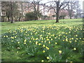 |
Daffodils in Margravine Cemetery
by Marathon
Margravine (or Hammersmith) Cemetery was opened in 1868 and the first burial took place on 3 November 1869. The cemetery became a Garden of Rest in 1951 when the then Hammersmith Council, concerned at its dilapidated appearance, decided to... (more)
|
 |
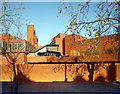
New Apostolic Church
by N Chadwick
|
 |
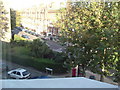
Barons Court Underground station: view from Margravine Gardens |
 |
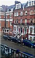
Think Hotel, Warwick Road W14
by Robin Sones
At the junction of Fenelon Place W14
|
 |
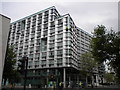
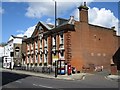
Hammersmith & West London College
A real point and shoot taken through the bus window while crawling along in traffic. Good colours though in the bright sunlight. You can see why they call these places Redbricks, can't you.
|
 |
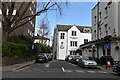
Munden Street, Olympia, London |
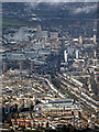 |
West London from the air
Kensington Olympia is prominent in the foreground, with the Westfield Centre in the distance.
|
 |
Barton Road/Barons Court Road junction
by susan mccall
|
 |
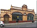
West Kensington Underground station, London
Opened in 1874 by the Metropolitan District Railway on what later became the District line from Central London via Turnham Green to Ealing Broadway. A new entrance building was provided in 1927. View west towards Barons Court and Turnham... (more)
|
 |
Avonmore Road
by Lauren
|
 |
West London County Court, 43-45, North End Road
Grade II listed Link |
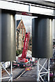 |
Framed
Crane on a road construction site, with St.Cuthbert's Church, Earl's Court, in the background. It would appear that the new service road relates to the development of the Earl's Court exhibition site. The scene is framed by... (more)
|
Explore more images in this square: | View Filtering options | View all 523 images page by page >>> |
|