Grid reference TQ488847
near to Dagenham, Barking And Dagenham, England
Coverage
We have 57 images in grid square TQ4884
Contribute
Explore centiquare TQ488847
Explore gridsquare TQ4884
Surrounding area
Maps
 Map © Crown Copyright")
TIP: Click the map for more Large scale mapping
Tip: Click the map to open the coverage map
Sample images Breakdown list images taken from TQ4884 [2]
A sample of 12 photos from 57 for TQ4884 - View this square in the Browser >>>
 |
St Alban, Vincent Road, Becontree - Banner
by John Salmon
MU Banner
|
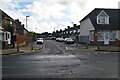 |
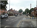
Talbot Rd
by N Chadwick
|
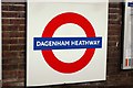 |
Dagenham Heathway station
The world famous London Transport 'Bullseye' roundel, this time at Dagenham Heathway station on the District Line.
|
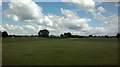 |
View of Parsloes Park Sports Pavilion from Parsloes Park
by Robert Lamb
Looking east.
|
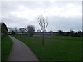 |
Path in Goresbrook Park
This path leads from Chaplin Road towards Dagenham Avenue. It passes through the large grassed open space.
|
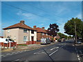 |
Hedgemans Road, Becontree
Hedgemans Road, on the Becontree Estate.
|
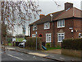 |
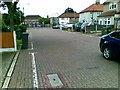
Ivy Walk, Becontree
The houses here are typical of the inter-war Becontree Estate, a vast area of housing built by the old London County Council to relieve overcrowding in the East End. To many of the estate's first residents it must have seemed like... (more)
|
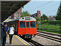 |
District Line train at Dagenham Heathway
A westbound train, composed of D78 stock.
|
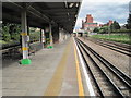 |
Dagenham Heathway Underground station, Greater London
Opened in 1932 by the London Midland & Scottish Railway on the line from London to Upminster, this station transferred from British Rail to London Transport in 1969. View east towards Dagenham East and Upminster. Like 55% of the London... (more)
|
 |
Walfrey Gardens, Dagenham |
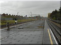 |
Looking west from Dagenham Heathway Underground station
by Marathon
The London, Tilbury & Southend Railway opened its line from Forest Gate via Barking and Dagenham Dock to Tilbury in 1854. In 1858 the company opened a cut off between Bow and Barking. What is now the C2C line was opened in 1885 by... (more)
|
 |
Hedgemans Road, Dagenham |
Explore more images in this square: | View Filtering options | View all 57 images page by page >>> |
|