


<< Text Pages >> Higher Bury Camp - Hillfort in England in Devon
Submitted by SolarMegalith on Tuesday, 01 October 2013 Page Views: 2098
Iron Age and Later PrehistorySite Name: Higher Bury CampCountry: England County: Devon Type: Hillfort
Nearest Village: Harford
Map Ref: SX79789572
Latitude: 50.748597N Longitude: 3.705451W
Condition:
| 5 | Perfect |
| 4 | Almost Perfect |
| 3 | Reasonable but with some damage |
| 2 | Ruined but still recognisable as an ancient site |
| 1 | Pretty much destroyed, possibly visible as crop marks |
| 0 | No data. |
| -1 | Completely destroyed |
| 5 | Superb |
| 4 | Good |
| 3 | Ordinary |
| 2 | Not Good |
| 1 | Awful |
| 0 | No data. |
| 5 | Can be driven to, probably with disabled access |
| 4 | Short walk on a footpath |
| 3 | Requiring a bit more of a walk |
| 2 | A long walk |
| 1 | In the middle of nowhere, a nightmare to find |
| 0 | No data. |
| 5 | co-ordinates taken by GPS or official recorded co-ordinates |
| 4 | co-ordinates scaled from a detailed map |
| 3 | co-ordinates scaled from a bad map |
| 2 | co-ordinates of the nearest village |
| 1 | co-ordinates of the nearest town |
| 0 | no data |
Internal Links:
External Links:
An Iron Age univallate hillfort with a rampart preserved up to 2m of height.
Read More at Pastscape.
You may be viewing yesterday's version of this page. To see the most up to date information please register for a free account.
Do not use the above information on other web sites or publications without permission of the contributor.
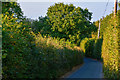
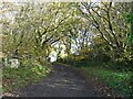
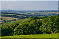
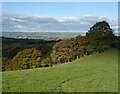
Nearby Images from Geograph Britain and Ireland:
©2018(licence)
©2020(licence)
©2018(licence)
©2020(licence)
©2018(licence)
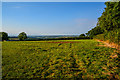
The above images may not be of the site on this page, they are loaded from Geograph.
Please Submit an Image of this site or go out and take one for us!
Click here to see more info for this site
Nearby sites
Key: Red: member's photo, Blue: 3rd party photo, Yellow: other image, Green: no photo - please go there and take one, Grey: site destroyed
Download sites to:
KML (Google Earth)
GPX (GPS waypoints)
CSV (Garmin/Navman)
CSV (Excel)
To unlock full downloads you need to sign up as a Contributory Member. Otherwise downloads are limited to 50 sites.
Turn off the page maps and other distractions
Nearby sites listing. In the following links * = Image available
1.8km NE 37° Posbury Camp Hillfort (SX80889711)
4.0km NE 42° Uton Holy Well* Holy Well or Sacred Spring (SX825986)
4.0km WNW 293° Lethen Castle Hillfort (SX761974)
5.8km NE 37° St Boniface's Well (Crediton)* Holy Well or Sacred Spring (SS834003)
5.9km NE 38° Libbett's Well* Holy Well or Sacred Spring (SS835003)
7.1km SSW 205° Wooston Castle* Hillfort (SX76608935)
7.4km NNW 337° Copplestone Cross* Ancient Cross (SS7706802606)
7.6km SW 220° Prestonbury Castle* Hillfort (SX7477490045)
8.3km NW 305° Puddock's Well* Holy Well or Sacred Spring (SS731006)
8.4km SSW 198° Headless Cross (Moretonhampstead)* Modern Stone Circle etc (SX77068781)
8.4km SW 220° Charles Cross* Ancient Cross (SX742894)
8.4km NE 49° Shobrooke Church Preaching Cross Ancient Cross (SS863011)
8.5km NE 48° Shobrooke Holy Well* Holy Well or Sacred Spring (SS8632301236)
8.6km SSW 199° Mardon Down N* Stone Circle (SX76758768)
8.6km SSW 198° Marden Down East* Ring Cairn (SX76908760)
8.7km SSW 212° Butterdon Down Cairns* Barrow Cemetery (SX75028843)
8.8km SSW 199° The Giant's Grave Mardon Down* Cairn (SX76768746)
8.8km SSW 199° Mardon Down Cairn 3* Cairn (SX7677487432)
8.9km SSW 213° Butterdon Down West* Standing Stone (Menhir) (SX74788840)
8.9km SSW 198° Mardon Down Mortar Pit* Modern Stone Circle etc (SX76808735)
8.9km SW 220° Cranbrook Castle* Hillfort (SX7386889010)
9.0km SSW 198° Mardon Down Ring Cairn* Ring Cairn (SX7672987264)
9.0km SSW 198° Mardon Down S* Stone Circle (SX76768719)
9.1km SSW 198° Mardon Down Cairn 1* Cairn (SX76768716)
10.6km SSW 202° Moretonhampstead Cross* Ancient Cross (SX7550886039)
View more nearby sites and additional images

