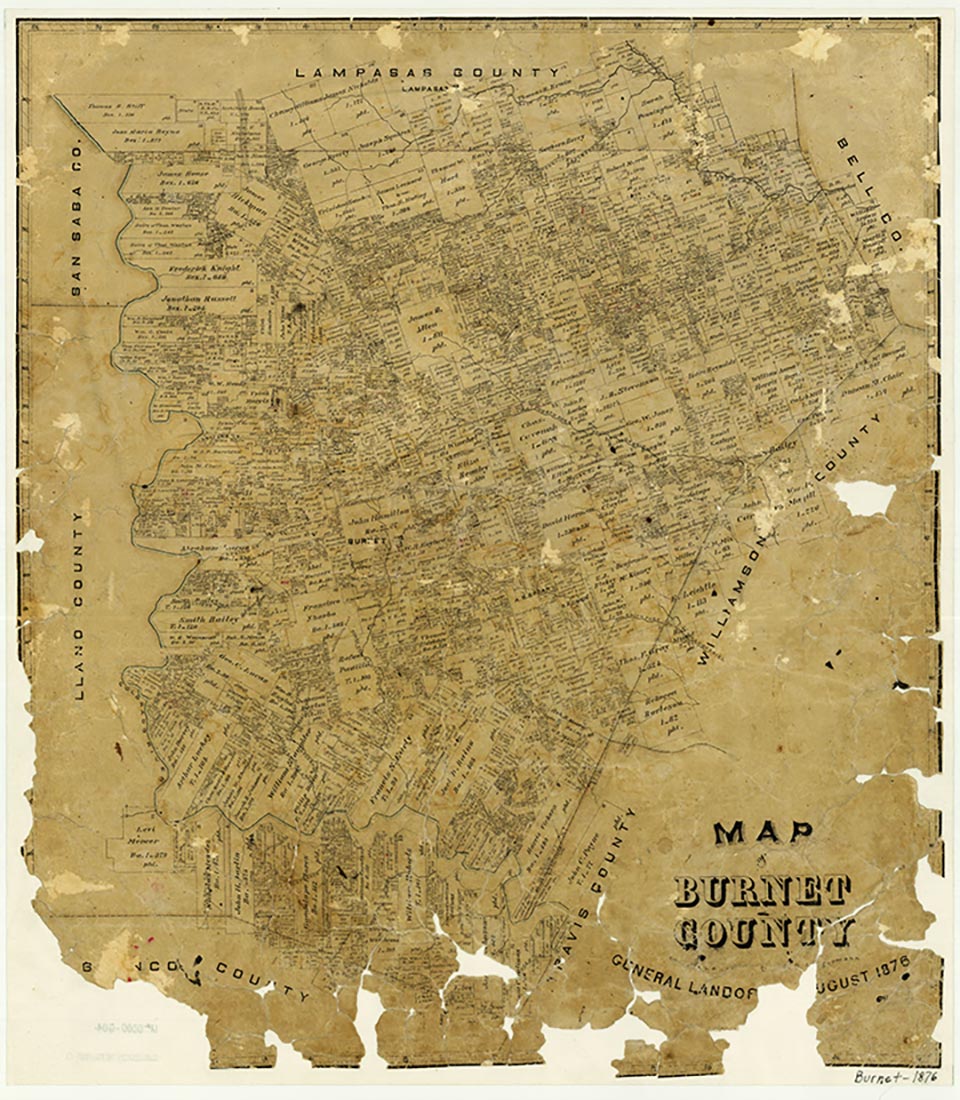
Burnet County in central Texas, is bordered by Lampasas, Bell, Williamson, Travis, Blanco, Llano, and San Saba counties. Burnet, the county seat, is at the intersection of U.S. Highway 281 and State Highway 29 and on the Austin Area Terminal Railroad, about fifty miles northwest of Austin and 150 miles southwest of Fort Worth. The county's center is about three miles northeast of Burnet at 30º47' north latitude and 98º11' west longitude. The county, situated on the northeastern edge of the Hill Country, comprises roughly 1,000 square miles of gentle to broken hills with elevations ranging from 700 to 1,700 feet above sea level. The terrain in the northwestern, western, and southern parts of the county is characterized by rolling hills with local deep and dense dissections; fertile plateaus and valleys are found in the eastern section, and rolling prairies dominate the north and northeast. The land is drained by the Colorado River, which forms most of the western county line before meandering across the southern part of the county; by the San Gabriel River, which rises in three forks in the northern and central parts of the county; and by the Lampasas River, which cuts across the northeastern corner. Wildlife in Burnet County includes deer, coyotes, bobcats, beaver, opossums, ring-tailed cats, foxes, raccoons, turkeys, badgers, weasels, skunks, and squirrels, as well as assorted birds, fish, and reptiles. Among the county's mineral resources are granite, limestone, industrial sand, and graphite. The average minimum temperature is 37° F in January, and the average maximum is 96° in July. The growing season averages 234 days annually, and the rainfall averages about thirty inches.
Central Texas, including Burnet County, has supported human habitation for several thousand years. Although the archeology of Burnet County has not been fully studied, several prehistoric campsites have been found along the rivers and their tributaries. The hunting and gathering peoples who had established themselves in the area by about 4500 b.c. were probably ancestors of the Tonkawa Indians. No evidence of Spanish exploration or settlement has been found in Burnet County, although missions were established in the 1740s and 1750s in neighboring San Saba County. In the early nineteenth century, surveyors found the local Tonkawa and Lipan Apache groups to be friendly, but the Comanches made frequent raids into the area.
The northeastern section of Burnet County was included in the colonization grant obtained by Robert Leftwich from the Mexican government in 1825, and was later part of Robertson's colony. No grants were made in the Burnet County area of the colony until 1835. The remainder of the county was part of the Austin-Williams colony, but no grants were made in the county under that contract. Several surveying and Indian-fighting expeditions from the colonies of Stephen F. Austin and Green DeWitt ventured into Burnet County in the 1820s and 1830s, but no permanent settlement occurred. At the time of Texas independence, most of the area was still public domain; through the mid-1840s settlers preferred the relative security of communities farther to the east.
In the 1840s, after the annexation of Texas to the United States, the federal government became responsible for the protection of frontier settlers from Indian raids. Several companies of Texas Rangers, financed by the federal government, were stationed along the frontier. In December 1847 a company commanded by Henry E. McCulloch took up a position about three miles south of the site of present Burnet. Samuel E. Holland visited McCulloch's station in 1848 and purchased the 1,280-acre John P. Rozier grant, including the land on which the ranger station was located; the residence he built on that land is said to have been the first permanent home in Burnet County. When the Rangers were relieved by a company of United States Dragoons in December, 1848, Holland protested the construction of a fort on his property; as a result, Fort Croghan was established at the site of future Burnet, three miles to the north. The military abandoned Fort Croghan in December 1853, when it was thought that the population of the area was sufficient to hold its own against the remaining Indians.
The presence of troops had encouraged settlers to make their homes in Burnet County. Among these were such county notables as Noah Smithwick, Logan Vandeveer, and Peter Kerr. A group of Mormons led by Lyman Wight established a colony at the falls of Hamilton Creek in 1851. By December 1851 the population of the region was large enough to warrant petitioning for the foundation of a new county. Burnet County was formed by the Fourth Texas Legislature on February 5, 1852, from parts of Travis, Williamson, and Bell counties. It was named for David G. Burnet, president of the provisional government of the Republic of Texas. The first county officials were elected later that year.
Residents of the new county were divided on the issue of where to locate the county seat. Some thought it should be on Oatmeal Creek, east of the watershed separating the Brazos and Colorado rivers; others wanted it to be on Delaware Creek, just southwest of the site of Burnet. The faction that won included Vandeveer, Holland, and Kerr, who argued that Hamilton should be the county seat. To help convince people, Kerr donated 100 acres to the county for a townsite. The first post office in the county was established at Hamilton in 1853; the name of the town was changed to Burnet in February 1858.
By 1860 Burnet County had 2,487 residents. Aside from Burnet, the earliest settlements in the county were Smithwick, Oatmeal, and the Backbone Valley community. Stock raising and subsistence farming formed the basis of the early economy. In 1860 county farmers reported having more than 30,000 head of cattle and 11,000 hogs; they grew corn and wheat as food crops, producing 23,900 and 10,200 bushels respectively.
The first efforts at education in Burnet County were hampered by the constant threat of Indian attacks. In the 1850s some early schools were conducted under shade trees, the older boys keeping rifles ready for protection. Small community schools, such as those at Hairston Creek, Pool Branch, Hoover's Valley, and Oatmeal, provided basic education in the county until the establishment of a district system in the 1890s. Marble Falls Alliance University was established in 1890, but did not last long as a college. Extensive schooling for most children was a luxury that came second to helping out on the family farm. In 1896 the county superintendent of schools reported a need for a uniform series of textbooks, better enrollment and attendance, better teaching conditions, and more experienced teachers. Improvements in the system came slowly: in 1940 only 10 percent of the county's population over twenty-five years old were high school graduates. Large-scale consolidation of common-school districts into larger, independent school districts took place in the 1930s and 1940s. As the job market expanded during the next forty years, so did the percentage of residents who finished school. By 1960 nearly 18 percent were high school graduates, and by 1980 the number represented more than 60 percent of the population over twenty-five.
Among the earliest churches in the county were a congregation at Mormon Mill in 1851, a Christian church established at Sycamore Springs in 1851, a Baptist church established on Oatmeal Creek in 1854, and a Church of Christ established at Burnet in 1856. Few communities had their own preacher; itinerant ministers held periodic camp meetings to which people came from miles away. One of the first of these was held in the fall of 1855 by Methodists at Sand Springs, south of Burnet. The first land deed specifically for church purposes was executed in 1859 in Backbone Valley. Most often, early church services were held in a building that also served as the schoolhouse. A Catholic church was established at Burnet in 1930; an African Methodist Episcopal church was established there in 1953. In the early 1980s the county's forty-seven churches had an estimated combined membership of 10,329; Southern Baptist, Church of Christ, and United Methodist were the largest denominations.
Although most early residents of Burnet County came from other Texas counties or other Southern states, the slave population was relatively small; the 235 slaves reported in the 1860 census were divided among sixty-nine owners. The greatest concentration of slaves was in the area of Spicewood and Double Horn Creek. Among the factors contributing to the low number of slaves was the fact that Burnet County was relatively new, and residents had not had time to acquire a great deal of property; also, the soil in the county did not lend itself well to large-scale farming. There were several big ranches in the county, but no plantation-like operations.
Thomas Moore represented Burnet County at the Secession Convention in January 1861 and voted for secession; county voters, however, rejected the ordinance of secession later that year by a margin of 248 to 159. The issue continued to be a source of division, as demonstrated by the number of Unionists' bodies found at Dead Man's Hole, but in spite of the initial majority opposition to secession, residents of Burnet County contributed both men and supplies to the Confederate war effort. More tension would likely have existed between Unionists and secessionists, except that most of the men who were part of the Confederate Army were in frontier companies formed to protect the county more from outlaws and Indians than from Yankees. Crime was rampant in Burnet County in the 1860s and 1870s. In addition to occasional Indian raids, residents had to contend with counterfeiters and cattle thieves. There were also incidents of White outlaws masquerading as Indians so as to divert blame from themselves. During Reconstruction, several Burnet County men, who had been active in the pursuit of outlaws and Indian raiders, were arrested by Union forces, taken to Austin, and held for several weeks on charges of impeding Reconstruction. Although the men were later released, the incident caused considerable ill-feeling. In 1869 the county's lopsided election returns for Andrew J. Hamilton over Edmund J. Davis indicated that the local government had been returned to Democratic rule.
In presidential politics, Burnet County was staunchly Democratic from the end of Reconstruction until the 1970s, the only exception being a vote of 936 to 467 for Herbert Hoover over Al Smith in 1928. Burnet County voters began to trend Republican in presidential elections after 1972, when Richard Nixon carried the area over Democrat George McGovern. Though Democrat Jimmy Carter won most of the county’s votes in 1972, Republican presidential candidates won majorities in the county in every election from 1980 to 2004. Burnet County suffered a severe economic decline immediately after the Civil War and throughout Reconstruction. Between 1864 and 1866, the county as a whole lost 64 percent of tax revenues. A little more than a quarter of the loss was in slaves; the rest came from declines in total farm acreage, farm value, and livestock value, each of which fell 25 to 50 percent by the time of the 1870 census. Recovery was slow because transportation was poor and the economy was so dependent on agriculture.
After the war some former slaves left the county, but many stayed. A group of them settled on land in the eastern part of Oatmeal. In 1870 the Black population of the county had increased to 358, keeping pace with the growth of the total number of residents; the number of Blacks had fallen to 248 by 1880, however, and the number of new White residents was such that after 1890, Blacks represented less than 3 percent of the total population. Some found work on farms and ranches, but by the turn of the century many had moved into the Marble Falls area to work in town.
The Burnet County economy began to show signs of recovery in the late 1870s and early 1880s. People from other Texas counties and other states had pushed the total population to 6,855 by 1880, and the census reported 951 farms in the county, up from 281 in 1870. Although the number of cattle and hogs on farms had not yet regained prewar levels, the number of sheep had risen from just under 5,800 in 1870 to nearly 25,000 in 1880, when the county produced nearly 90,000 pounds of wool. By 1890 farm values had doubled and livestock production had increased sharply; the county had more than 40,000 cattle, 15,000 pigs, and nearly 59,000 sheep. Also by 1890 the population had risen to 10,747, as the number of people moving in from other states were supplemented by immigrants from England, Scotland, Germany, Sweden, and Mexico. With the exception of a decrease in population in 1920 to 9,500, the number of residents in Burnet County remained fairly stable for the next sixty years.
The Austin and Northwestern finished laying the track between Austin and Burnet in 1882. The track to Granite Mountain was built in the mid-1880s, and branches to Marble Falls and Llano were completed by 1889 and 1892, respectively. The Houston and Texas Central Railway was completed from Burnet to Lampasas in 1903. Lake Victor and Bertram were established as railroad towns and prospered as shipping points and commercial centers for area farmers and ranchers. Such other communities in the county as Lacy, Naruna, South Gabriel, Sage, Wolf's Crossing, Shady Grove, and Strickling were bypassed by the railroads and faded as their populations were drawn to more promising locations.
One beneficiary of the additional railroad lines was the mining industry. Although the quarry at Granite Mountain had been in operation for several years, shipping became much easier with the arrival of the railroad. Stone from the Granite Mountain quarry was used for the Capitol in Austin, the Galveston seawall, numerous county courthouses, and several buildings in New York. Graphite proved to be another profitable mining venture. The deposits in the northwestern part of the county, discovered in 1916, were the Western Hemisphere's only fully integrated primary source of graphite. The Southwestern Consolidated Graphite Company began operation in the late teens; the mining stopped because of the Great Depression of the 1930s, but began again at the request of the War Production Board in 1942. Mining for lead, copper, zinc, iron, and gold was also attempted in Burnet County, but with little success.
Agriculture benefited from the increased accessibility of markets as well. Cotton became an important crop in the 1880s. In 1880 farmers planted just over 7,000 acres, or 12 percent of the county's improved land, and produced about 1,400 bales; cotton acreage had tripled by 1890, when 20,500 acres, or 34 percent of the improved land, produced 8,650 bales. Stock raising, especially sheep and goat ranching, was also an important occupation in Burnet County in the late nineteenth and early twentieth centuries. The number of sheep reached 80,800 in 1910, fell sharply to 42,000 by 1920, but then nearly tripled by 1930 to 120,800. The number of goats on farms rose from just over 8,500 in 1920 to nearly 60,000 in 1930; mohair production for the county showed a corresponding increase from 18,000 to 218,000 pounds.
When the depression hit in the 1930s, however, prices for all agricultural products plummeted. Cotton, which averaged sixteen cents a pound in 1929, sold for only five cents in 1931; wheat prices fell as low as forty-five cents a bushel. The value of livestock dropped as well: a ewe and lamb that cost twenty dollars in 1929 sold for two dollars; wool, which sold for forty cents a pound in the late 1920s, fell to seven or eight cents. Lower prices meant lower income for farmers and lower wages for their hired workers. Many farmers had difficulty obtaining enough credit to continue operating. The number of farms in the county fell from 1,548 in 1930 to 810 in 1960.
Unemployed farmers who were unprepared for other kinds of work had to accept help from government relief and public-works projects. Burnet County received more than $387,000 in relief through the Agricultural Adjustment Administration between 1933 and 1935. The Work Projects Administration employed men to improve streets and public property and set up sewing rooms and painting classes for women. A company of the Civilian Conservation Corps was stationed at the newly established Longhorn Cavern State Park in 1934. In addition, the National Youth Administration established a camp at Buchanan and Inks dams in 1938 to provide part-time employment for out-of-school youth, ages eighteen to twenty-four. The program was continued for the construction of a national fish hatchery at Inks Dam in 1939.
Another major employer during the depression was the State Highway Department (now the Texas Department of Transportation). In 1929, construction of the Burnet County section of State Highway 66 (later U.S. Highway 281) began; the project lasted until 1939. State Highway 29, which connected Austin with Burnet and Buchanan Dam was built between 1936 and 1939. These north-south and east-west routes each required a large bridge to cross the Colorado River; one bridge, located at Marble Falls, was completed in 1936, and the second was built across Inks Lake about a mile below Buchanan Dam in 1937.
By far the largest project, however, was the development of the Colorado River as a source of hydroelectric power. Harnessing the power of the river had been a dream of Burnet County residents since the early days of settlement. In 1854, Adam Rankin Johnson had envisioned a dam that would supply power to factories for the manufacture of cotton and woolen products, as well as help prevent floods. Although several attempts were made to tame the river, none was successful until that of the Lower Colorado River Authority in the 1930s. Hundreds of people were employed in the construction of Hamilton (later renamed Buchanan) and Roy B. Inks dams (seeINKS LAKE, andLAKE BUCHANAN). Many of the jobs were unskilled, but they were steady, and in most cases the income from them enabled people to maintain their standard of living.
Agriculture in Burnet County had for the most part recovered by the early 1940s, but farming as an occupation was less prevalent than it had been before the depression. Land previously under cultivation was now used for grazing; crop raising was relegated primarily to the northeastern part of the county. Larger farms and ranches squeezed out the small farmer and sharecropper. Tenant farming and sharecropping, which had accounted for the operation of nearly 29 percent of the county's farms in 1880, increased steadily in the late nineteenth and early twentieth centuries, peaking at 54 percent in 1930. In 1940 roughly 49 percent of the farms were tenant-run; in 1950 the number had fallen to 23 percent; by the late 1960s fewer than 13 percent of the farms in the county were operated by tenants. The average farm size had increased from 380 acres in 1930 to 695 in 1960.
The LCRA built two more dams on the Colorado in Burnet County in the late 1940s and early 1950s: Alvin J. Wirtz Dam, which impounded Lake Lyndon B. Johnson, and Max Starke Dam, on Lake Marble Falls. Subdivisions on the lake shores were popular sites for retirement and vacation homes. By the 1970s retired couples comprised a significant part of the population; in the early 1980s, Burnet County ranked seventieth of all counties in the United States in percentage of population over age sixty-five. Burnet County had an urban growth of 133 percent between 1970 and 1980, one of the highest in the state. Lake Buchanan, Inks Lake, Lake Lyndon B. Johnson, and Lake Marble Falls were popular recreational sites.
In the early 1980s between 80 and 90 percent of the land in the county was devoted to farming or stock raising. Only about 4 percent of the farmland was under cultivation; hay, oats, and wheat were the primary crops. Most of the farmland was located in the northeastern part of the county. More than 90 percent of the county's agricultural receipts came from livestock, the most important animals being cattle, sheep, angora goats, and hogs. Although agriculture continued to be an important aspect of the economy, farm receipts represented less than 6 percent of the county's annual income in the early 1980s. Roughly three-quarters of the county's farmers and ranchers depended on other work to supplement their income.
Professional and related services, manufacturing, wholesale and retail trade, and construction involved more than 60 percent of the workforce in the 1980s; an additional 17 percent was self-employed, and 24 percent was employed outside the county. Industries with the highest employment included limestone quarrying, agribusiness, general construction, and the manufacture of wood cabinets. In 1980 Burnet County had 17,803 residents, a 56 percent increase over the 1970 population of 11,420; the population increased a further 27 percent in the late 1980s, reaching 22,677 in 1990.
The U.S. Census counted 44,943 people living in Burnet County in 2000; about 74.6 percent were Anglo, 21.4 percent Hispanic, and 2.2 percent African-American. Of those twenty-five and over, 70 percent had graduated from high school and 18 percent had college degrees. In the early twenty-first century tourism, various manufacturing concerns, stone processing, and hunting leases were important elements of the area’s economy. In 2002 the county had 1,370 farms and ranches covering 565,413 acres, 68 percent of which were devoted to pasture, 19 percent to crops, and 10 percent to woodlands. That year farmers and ranchers in the area earned $10,257,000; livestock sales accounted for $9,443,000 of the total. Beef cattle, goats, and hay and were the chief agricultural products.
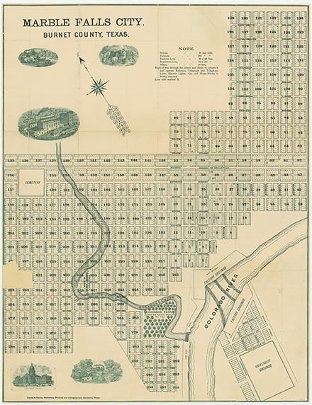
Burnet (population, 6,144) is the county’s seat of government; other communities include Marble Falls (6,208), Granite Shoals (5,042), Meadowlakes (1,848), Cottonwood Shores (1,148), Bertram (1,398), Highland Haven (347), and Briggs (172). Tourists travel to the area to boat and swim in Lake Buchanan and Lake LBJ; annual events include Bertram’s Oatmeal Festival, held on Labor Day, Burnet’s Bluebonnet festival in April, and the drag boat races held in Marble Falls in August.
Is history important to you?
We need your support because we are a non-profit that relies upon contributions from our community in order to record and preserve the history of our state. Every dollar helps.
Malvin George Bowden, History of Burnet County (M.A. thesis, University of Texas, 1940). R. S. Crawford, Jacob Wolf: Burnet County Pioneer (Waco: Texian Press, 1969). Darrell Debo, Burnet County History (2 vols., Burnet, Texas: Eakin, 1979). Noah Smithwick, The Evolution of a State, or Recollections of Old Texas Days (Austin: Gammel, 1900; rpt., Austin: University of Texas Press, 1983).
The following, adapted from the Chicago Manual of Style, 15th edition, is the preferred citation for this entry.
Vivian Elizabeth Smyrl, “Burnet County,” Handbook of Texas Online, accessed April 26, 2024, https://www.tshaonline.org/handbook/entries/burnet-county.
Published by the Texas State Historical Association.
TID: HCB19
All copyrighted materials included within the Handbook of Texas Online are in accordance with Title 17 U.S.C. Section 107 related to Copyright and “Fair Use” for Non-Profit educational institutions, which permits the Texas State Historical Association (TSHA), to utilize copyrighted materials to further scholarship, education, and inform the public. The TSHA makes every effort to conform to the principles of fair use and to comply with copyright law.
If you wish to use copyrighted material from this site for purposes of your own that go beyond fair use, you must obtain permission from the copyright owner.