If you have traveled on a London bus in the past month, you might have noticed something new. Passengers on routes such as the 148, between Camberwell and Shepherd's Bush, may have noticed that each time the bus approaches a stop, a recorded voice tells them which one it is, similar to the announcements made on the tube. It seems a subtle, if slightly annoying, addition to the bus. Especially if, like most on board, you already know which stop is next.
But then again, any changes to the London buses matter. They're one of the greenest, cheapest, most convenient forms of transport, knitting the metropolis together even more comprehensively than the vast tube system, stretching to the furthest reaches of the capital, right around the clock. The trouble is they rarely run to schedule, tending to bunch in convoy as if they were scared to travel alone.
For a decade, controllers working in the command centre have been able to estimate where each bus is. Using analogue "band 3" radios that are part of the spectrum being phased out by the government, controllers could give passengers a good guess about how far the next bus was away. But it was just a guess.
Wheel change
Transport for London (TfL), the tax-funded body responsible for public transport in the capital, is spending £117m upgrading its bus fleet with a new communications system. Each bus will get a Windows-based computer, GPS unit, turn-rate sensor and speedometer to help controllers know exactly where it is. Add some complex journey algorithms and you can locate every bus to an accuracy of about 10 metres, or its distance from the nearest stop by around 10 seconds.
By the summer of next year, every bus will be able to tell you which stop is next. It will not only tell you where to alight, but real-time information will be distributed to the LED signs at major bus stops. This is no mean feat in a network as vast as London's: 8,200 buses make more than 6m passenger journeys every day.
The city, moreover, is planted with a forest of 19,000 bus stops, each with its own name. The so-called iBus will announce them all, as well as the big transport hubs and tourist attractions. For example, the 36, which runs from New Cross Gate in south-east London via Paddington to Queens Park in north-west London, already signals stops such as The Old Lane, Hard Rock Cafe.
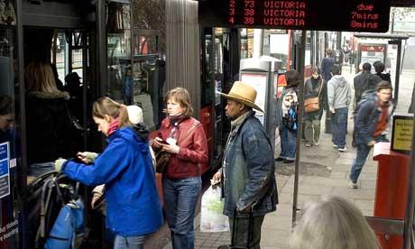
The red London bus is as close to an emblem for the city as any other and one of the things that visitors most associate with the city - even if, paradoxically, it is one they are most wary of taking. Tourists and even seasoned Londoners have reservations about buses when there is no way of knowing which stop is next - unlike the tube, where the journey is easy to follow on the map.
But not everyone is happy with the upgrade. Jags Minas, a bus enthusiast and blogger (route79.org/journal/), thinks passengers will become annoyed with the constant announcements. "After a while, most regular London bus passengers know exactly where their bus is at, even with their eyes closed," he says. (For visually impaired passengers, though, the announcements will be ideal.)
These will be augmented with more accurate information being displayed at major stops - but you will still have to reach the bus stop to get the information. What most passengers really want is real-time information before they reach the stop - on, say, their mobile phones. Such a system already exists in the Finnish capital, Helsinki, "where standing at a bus stop is something that most want to keep to a minimum", says Kerkko Vanhanen of Helsinki City Transportation.
Helsinki is roughly one-tenth the size of London, but has a public transport system that is rated the best in Europe by the European Commission (tinyurl.com/2849oo). Its latest developments give us an idea where the iBus should be heading.
Every bus and tram in Helsinki and the surrounding cities of Vaanta and Espoo are being fitted with Linux servers and GPS units. Every bus and tram in the conurbation will not only become a wireless hotspot serving broadband internet throughout the vehicle - for free - but every bus and tram is visible on a Google map (the beta version is at tinyurl.com/2gftso) that uses the same real-time passenger information as the controllers in their command centre.
The Google map, moreover, is open, meaning that if someone wants to come and improve it or write some extra application, they are free to do so. Not only that, but every bus and tram stop in Helsinki is being fitted with small "near field information" tags that allow anyone with a Nokia cameraphone to take a snap of the tag and launch a Java application bespoke to that stop. This means that you don't have to have to take off your mittens or tap in tricky Finnish place names such as herttoniemenranta when it's -22C and you're faced with sleet's bitter sting.
iBus, iPod?
Sadly, we're not likely to see such an advanced system in the UK this year or next. Like so many other publicly funded data projects, proprietary software has been commissioned by a public body and the data paid for by us remains in their hands.
Simon Reed, the iBus project director, is sanguine about the new system. "The priority is to get all the buses equipped, then we can start thinking about what we want to do with the real-time passenger information." TfL is about to put out a tender for a new generation of screens at bus stops, so perhaps some of the Finnish experience can be translated to London. It also has a working party looking at developing mobile applications to work off the back of iBus, as well as an upgrade of TfL's online journey planner to include real-time passenger information.
This surely should be the point. What most bus passengers want is a system that shares real-time information with them. Not just at the bus stop, but on our phones, iPods, laptops and websites. They don't want to go to the bus stop to find they have to wait 15 minutes - they want to find out how far away the bus is before they step outside. Now the controllers know where the bus is, soon the passengers will want to know too. How long will they have to wait?