Grid reference SD725375
near to Nethertown, Lancashire, England
Coverage
We have 46 images in grid square SD7237
Contribute
Explore centiquare SD725375
Explore gridsquare SD7237
Surrounding area
Maps
 Map © Crown Copyright")
TIP: Click the map for more Large scale mapping
Tip: Click the map to open the coverage map
Sample images Breakdown list
A sample of 12 photos from 46 for SD7237 - View this square in the Browser >>>
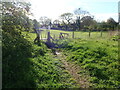 |
Footpath from Kingsmill Avenue
The footpath leading from the end of Kingsmill Avenue over the field to Common Side.
|
 |
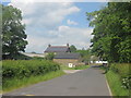
Track at Common Side
by philandju
Leading to the B6246, which leads to Mitton.
|
 |
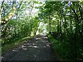
Turkey Lane |
 |
Mitton Road |
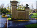 |
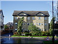
Calderstones Park
pretentious entrance to a housing estate - see other photo
|
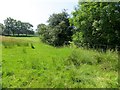 |
Rough pasture at Brook House Farm
by philandju
|
 |
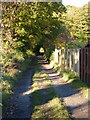
Calderstones Cemetery, Path |
 |
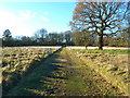
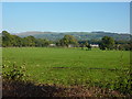
Field near Calderstones
by Chris Heaton
Pastures passed while walking the track from Whalley to Great Mitton.
|
 |
Brook House Farm
by John Slater
|
 |
Calderstones Park |
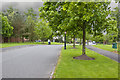 |
Calderstones Drive
by Ian Greig
|
 |
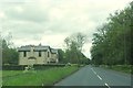
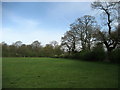
Pasture on the east side of Mitton Road |
Explore more images in this square: | View Filtering options | View all 46 images page by page >>> |
|