
High Resolution Version | National Radar Sites
Alaska | Guam | Hawaii | Puerto Rico
River levels and flood conditions.

Current obserations from NOAA's geostationary satellites.

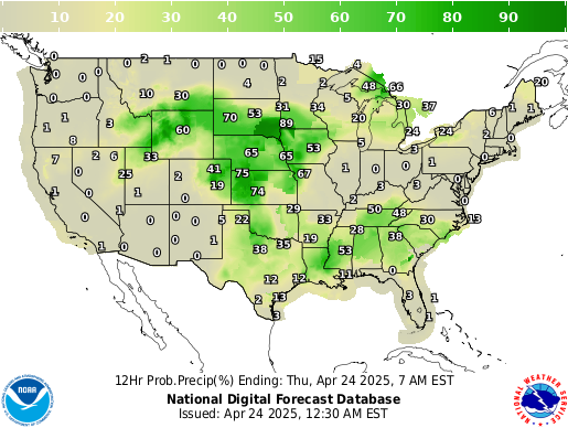
Observed precipitation over a 24 hour period


Upper air observations from radiosonde stations in North America, Pacific Islands, and Caribbean.

Daily maximum and minimum temperatures, snowfall, and 24-hour precipitation totals, as observed by a network of volunteer observers.
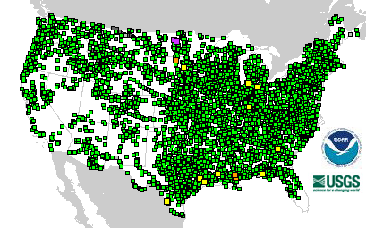
Atmospheric and oceanographic conditions reported from a global network of data collecting buoys.
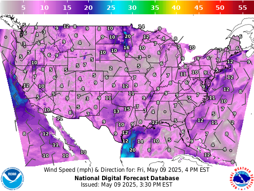
Temperature, sky conditions, visibility, precipitation type and accumulation, wind speed and direction, and more as reported by surface observation stations.


 Follow us on YouTube