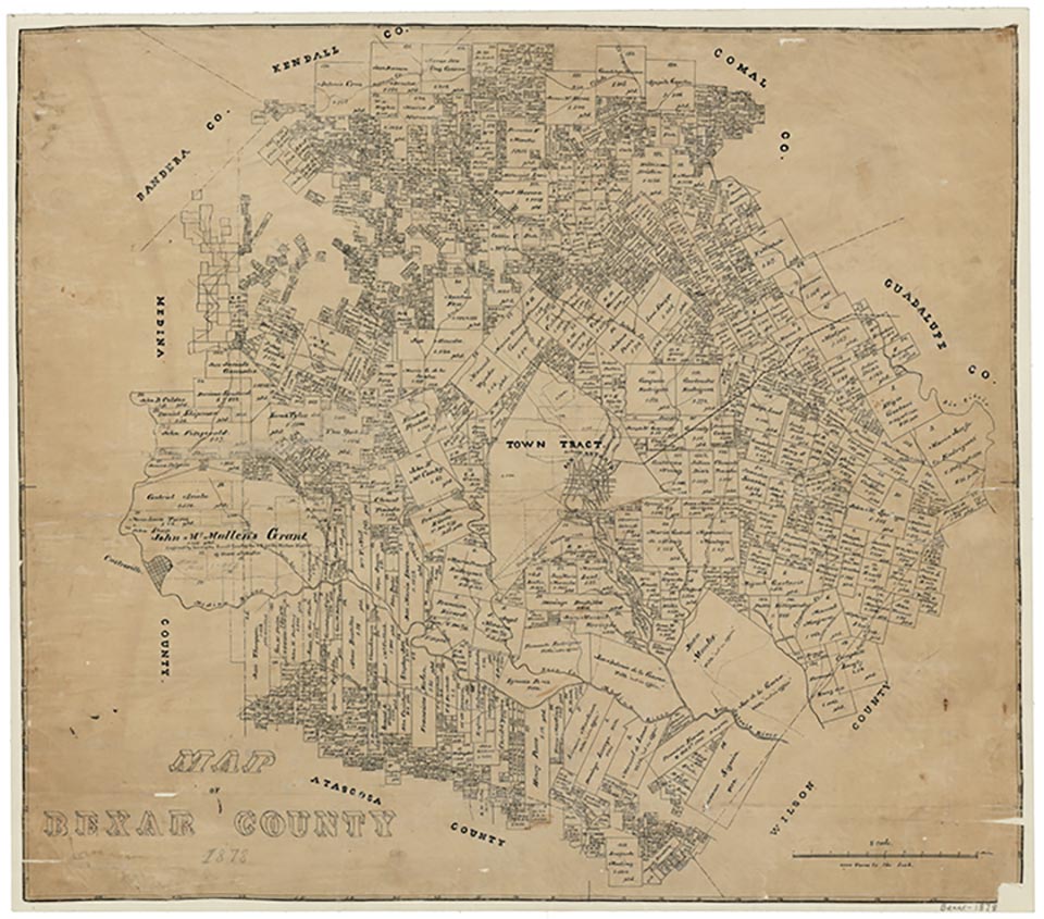
San Antonio, located at the head of the San Antonio River in Bexar County in south central Texas, is on Interstate Highway 10 (east-west) and Interstate highways 35 and 37 (north-south). The city is also served by five U.S. highways, numerous state highways as well as Interstate (Loop) 410 and State Loop 1604, San Antonio International Airport, Stinson Airport, Union Pacific Railroad, and daily AMTRAK train service. San Antonio, also known by such titles as the Alamo City, the Mission City, the River City, and Military City, U.S.A. (which the city trademarked in 2017), has a 300-year history that stretches back to Spanish Texas with the establishment of a presidio, town, and five Franciscan missions along the San Antonio River. The city’s strategic role in two separate struggles for independence—the fight for Mexican independence in 1811–13 and for Texas independence in 1835–36—resulted in bloody conflict but also eventually entrenched San Antonio’s standing as a state and national symbol of the battle for self-government. During the second half of the nineteenth century, San Antonio, as the largest city in Texas, supported a diverse native and immigrant population and further perpetuated its reputation as a crossroads of cultures. The city prospered as a center of agricultural and ranching activities, and its growing industry, advances in transportation, establishment of educational institutions, and strong connection to the military carried it firmly into the twentieth century and the post-World War II era. In recent decades San Antonio has become a top tourist destination.
Spanish expeditions explored the area in 1691 and 1709. In 1691 the expedition of Domingo Terán de los Ríos traveled through the region en route to East Texas and named the San Antonio River on June 13, the Feast Day of Portuguese Franciscan friar Saint Anthony of Padua. They also encountered an Indian area of settlement (which the Spaniards interpreted to have the name Yanaguana). The year 1691 has also been recognized as the beginning of a route, or more accurately a network of trails (caminos reales), that came to be known as the San Antonio-Nacogdoches Road (seeOLD SAN ANTONIO ROAD). With stretches most likely developed from existing Indian trails, the road developed into a main artery for commerce and immigration. The Espinosa-Olivares-Aguirre expedition in 1709 explored the future site of San Antonio and named the San Pedro Springs. Fray Isidro Félix de Espinosa reported on the abundance of water that “could supply not only a village but a city which could easily be founded here….” Indeed, a “city” later grew out of the San Antonio mission and presidio (1718) and San Fernando de Béxar villa (1731).
On May 1, 1718, Franciscan Antonio de San Buenaventura y Olivares established San Antonio de Valero, one of five Spanish missions to be located along the San Antonio River. On May 5, 1718, Martín de Alarcón, governor of the province of Texas, founded San Antonio de Béxar Presidio. Initially founded north of the present downtown area, in 1722 the presidio was relocated to the area surrounding San Antonio’s city hall, which sits on the site of Military Plaza. The fledgling community consisted of both military and civilian citizens—soldiers, Mexican frontiersmen, resident families, as well as the mission Indians. The land containing San Pedro Springs, considered as a vital water source for settlement, was declared by the Spanish crown in 1729 to be public land—a designation which makes San Pedro Springs Park one of the oldest municipal parks in the United States. The presidial captain’s house or Comandancia (later the Spanish Governor's Palace) was completed on Military Plaza in 1749. In 1731 Canary Islanders formed the villa of San Fernando de Béxar and established the first regularly-organized civil government in Texas. From San Pedro Spring they expanded an acequia that had been started by the military settlers to serve a large area of farmland between the river and San Pedro Creek to the south. They laid out town lots and drew up plans for what became Main Plaza and the site of the San Fernando de Béxar Church. Construction for the church, which was later designated San Fernando Cathedral in 1874, was completed by the late 1750s. Over time, the Canary Islanders, whose arrival initially disrupted the existing presidio community, forged economic and family bonds within the greater community.
In 1773 San Antonio de Béxar became the capital of Spanish Texas. A census of Béxar in 1777 listed a total population of 2,060; that number included 1,351 military and civilian residents and 709 mission residents (mostly mission Indians). Its circumstances were described as "miserable" by visitors. Primarily agricultural, the population was poor and heterogeneous, made up of Europeans, mestizos, Indians, and castas (racial/ethnic groupings). Persons of mixed race, mostly identified as mulatto, included individuals of American Indian/mestizo and American Indian/Black descent. Afro-Mexicans—people of African descent who were part of the Hispanic population of New Spain, included both free Blacks and a small number of slaves. Though stone houses near the town’s center comprised some structures, most of the dwellings were jacales—mud and stick huts with thatched roofs. In 1790 population numbers decreased to 1,878 (1,383 military and civilian residents and 495 mission residents). The San Antonio population also included fifteen Black families. Secularization of the missions began in 1793 with San Antonio de Valero Mission (later known as the Alamo), which in the early 1800s became a military barracks.
In the early nineteenth century San Antonio found itself at a crossroads of conflict. Growing sentiment against Spanish rule and in favor of Mexican independence had simmered since Miguel Hidalgo y Costilla’s call for independence in Mexico in 1810 and the subsequent Casas Revolt in San Antonio in 1811. In 1813 republican forces of the Gutiérrez-Magee expedition defeated Spanish royalists at the battle of Rosillo nine miles southeast of the city. The army known as the Republican Army of the North, which consisted of Anglos, Tejanos, Indians, Spanish army deserters, and former royalists, captured San Antonio on April 1, 1813, and declared independence as a republic under their “Green Flag” banner on April 6, 1813. In August the republican force of about 1,400, in the effort to spare the city, marched south to face Joaquín de Arredondo and his army, which included the young officer Antonio López de Santa Anna. The resulting battle of Medina in present-day Atascosa County on August 18, crushed the rebellion in the bloodiest battle ever fought in Texas. Arredondo enforced martial law in San Antonio. Suspected collaborators and republican sympathizers were killed or severely punished, and the city suffered the burden of an occupation army (seeLA QUINTA).
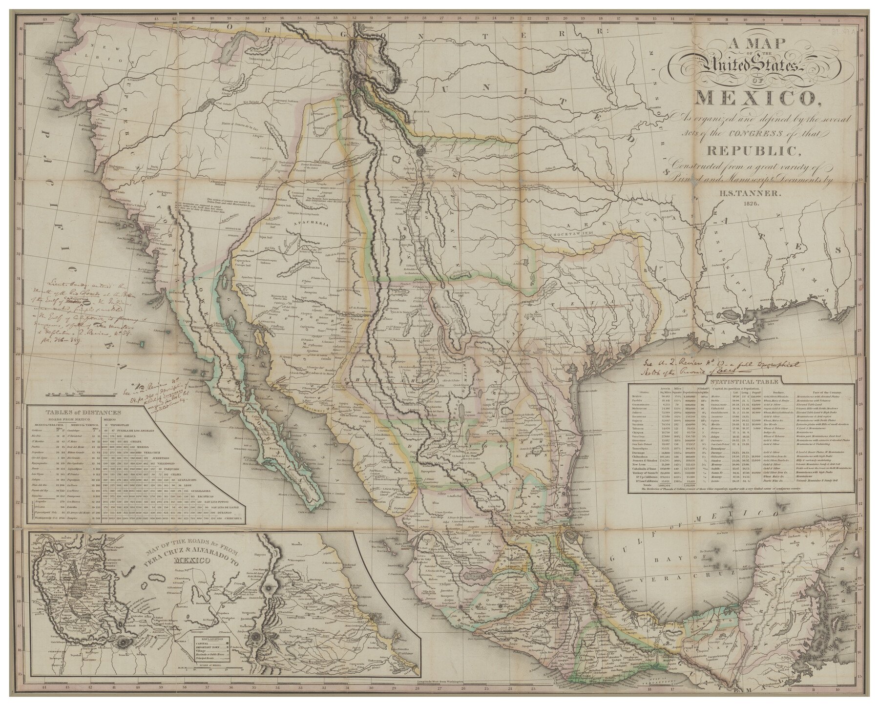
During the Mexican period, San Antonio lost its status as a provincial capital, when Texas was joined to neighboring Coahuila and the seat of government moved to far off Saltillo. San Antonio instead served as the seat of government for the Department of Texas until the early 1830s, when the state legislature created the departments of Texas and Brazos in response to population growth in Texas. In the immediate aftermath of Mexican independence, San Antonio served as the political center of the province, and its citizens actively lobbied for American immigration to support regional economic growth and Indian defense. Leading citizens of San Antonio participated in the drafting of both the Federal Constitution of 1824 and the Constitution of Coahuila and Texas of 1827. Most of the city’s leading men sided with the states’ rights factions in state and national politics, and in support of continued Anglo-American immigration. When Texas finally rebelled against Santa Anna and the Centralist government in Mexico City, city leaders sided with the rebels. The only two Tejano representatives to the convention at Washington-on-the-Brazos to sign the Texas Declaration of Independence were both San Antonio-born as was the leading Tejano military figure on the Texan side.
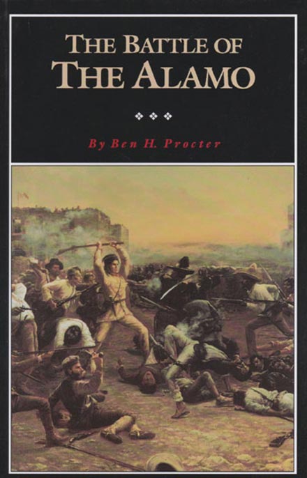
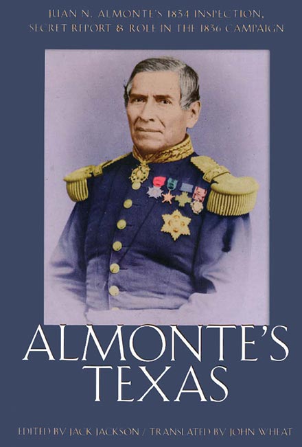
San Antonio once more became the site of critical campaigns during the Texas Revolution, including the siege of Bexar from October to December 1835 in which Texan forces ultimately wrested control of the city from Mexican defenses. On February 23, 1836, Texas soldiers garrisoned in the Alamo began their fateful stand against the larger Mexican army under the command of Gen. Antonio López de Santa Anna, who ordered the siege and ultimately the final assault that took place on March 6, 1836. The battle of the Alamo, which Alamo historian Stephen Hardin has characterized as the “most celebrated military engagement in Texas history,” immortalized San Antonio’s converted first Franciscan mission and its Texan defenders as symbols of sacrifice, and generations would recognize the rallying cry of “Remember the Alamo.”
Following the battle of San Jacinto and the evacuation of Mexican forces, Bexar County was organized by the Republic of Texas in December 1836, and San Antonio was chartered in January 1837 as its seat. The 1840 Census of the Republic of Texas recorded a total of 339 individuals listed on the county tax rolls (which included White males over the age of twenty-one, taxable property owners and/or their agents, executors, guardians, and administrators) and a total of thirty slaves. In 1840 a failed attempt to negotiate the release of captives held by Comanche Indians resulted in the Council House Fight—yet another battle in the streets of the town. San Antonio was seized twice in the Mexican invasions of 1842. The city’s history of conflict made it one of the most fought-over cities in North America.
After Texas entered the Union, growth became rapid, as the city became a servicing and distribution center for the western movement of the United States. Beginning with the Mexican War in 1846, the United States military established a presence in San Antonio that would forge a lasting connection with the city. The headquarters of the Eighth Military Department moved to San Antonio in 1848. The Quartermaster Depot occupied the Alamo in 1849 to the early 1850s until land south of the city was purchased in 1859, and the United States Army established the San Antonio Arsenal to serve as storage for ordnance and arms to supply army troops. In 1861 local militia forced the surrender of the federal arsenal at San Antonio even before the state seceded on March 2. Subsequently, San Antonio served as a Confederate depot. Several units such as John S. Ford's Cavalry of the West were formed there, though the city was removed from the fighting during the Civil War.
After the war, San Antonio prospered as a cattle, distribution, mercantile, and military center serving the border region and the Southwest. The city had experienced steady growth from a population of 3,488 in 1850 to 8,235 in 1860, when San Antonio had become for the time the largest town in Texas (ahead of Galveston). Germans made up a large part of this growth; German speakers outnumbered both Tejanos and Anglos until after 1877. The city was the southern hub and supplier of the cattle trail drives, and an important wool market developed with the importation of merino sheep to the adjacent Hill Country. Railroads in Texas had a profound effect on cities, and, with the coming of the Galveston, Harrisburg and San Antonio Railway in 1877, San Antonio, formerly without a transportation system, entered a new era of economic growth. In 1881 a second railroad, the International-Great Northern, reached the city from the northeast, and five railroads had built into the city by 1900.
The population reached 20,550 in 1880 and increased to approximately 45,000 for the city in 1887 (with a total population for Bexar County at 47,210). The new immigration was overwhelmingly native born Anglos, mostly from Southern states, but a breakdown of nationalities in the 1887 agricultural census for the county reflected a remarkable diversity in ethnicities. The First Annual Report of the Agricultural Bureau of the Department of Agriculture, Insurance, Statistics, and History listed the following breakdown of population groups in the county: “Americans 26,061, colored [African Americans] 3395, English 606, Germans 6146, French 564, Danes 26, Hebrews 90, Irish 1022, Italians 171, Mexicans 7688, Spanish 101, Swedes 30, Norwegians 12, Poles 447, Russians 64, Chinese 19, of all other nations 745.” In 1887 the city of San Antonio had a scholastic population of 10,037, but the number of students who were actually enrolled in school was 3,594. The city had ten schools and sixty-five teachers.
Modernization was explosive in the 1880s, comparable to growth patterns across the United States. Civic government, utilities, street paving and maintenance, water supply, telephones, hospitals, and a power plant were all established or planned. By the late 1880s the city’s two periodicals (which would be longtime competitors for more than a century), the Express and the Light, were publishing daily editions. Bexar County had 315 merchants, 100 lawyers, 32 physicians, and 9 banks. Notable industry in San Antonio in the late nineteenth century included Pioneer Flour Mills, Alamo Iron Works, Lone Star Brewery, San Antonio Brewing Association (seePEARL BREWING COMPANY), Alamo Cement Company, as well as merchandise stores such as Joske’s. In 1891 the first Battle of Flowers Parade was held in the city “as a patriotic celebration to…commemorate the victory at the Battle of San Jacinto.” Through the years, the popular event evolved into the city’s annual Fiesta. Long-established in downtown were the nightly open-air chili stands where “Chili Queens” served their Mexican fare of chili con carne, tamales, enchiladas, and other cuisine at Alamo Plaza, Market Square, and other locations. The colorful festive atmosphere drew commentary from writers Stephen Crane and O. Henry. In the late 1890s German immigrant William Gebhardt had opened a factory on West Commerce Street in the city to manufacture his own chili powder and would go on to market his product on a national scale.
Construction of a permanent army post on more than ninety-two acres located two and one-half miles northeast of the Alamo included a headquarters, a hospital, and some sixty other structures. In 1890 the post was designated Fort Sam Houston. During the Spanish-American War, the First United States Volunteer Cavalry mobilized in San Antonio and was supplied by Fort Sam Houston. Better known as the “Rough Riders,” the famed cavalry unit formed and trained in San Antonio under the direction of the unit’s celebrated recruiter and leader Lt. Col. Theodore Roosevelt.
San Antonio was once again the largest city in the state in 1900, with a population of 53,321. That figure ballooned to 96,614 in 1910. After 1910 Mexican immigration greatly increased due to the Mexican Revolution and the development of local service industries. The Spanish-language newspaperLa Prensa was founded in 1913 and went daily in 1914. The periodical kept readers abreast of events in Mexico, covered Mexican politics, and provided announcements for area Mexican and Mexican American organizations. The confluence of Hispanic, German, and Southern Anglo American cultures in San Antonio made it into one of America's "four unique cities" (along with Boston, New Orleans, and San Francisco). Frederick Law Olmsted had remarked on the city’s “jumble of races, costumes, languages and buildings” as early as the 1850s. Each successive group of immigrants put its stamp upon the city, its culture, and architecture; all mingled, none quite submerging the others. Each period of growth produced characteristic and often distinguished architecture. Peculiarly, San Antonio succeeded in merging its past into the new in each generation. Old Spanish walls remain beside modern glass towers, with rows of Victorian mansions a block away, a combination that contributed to the city’s charm and attracted millions of visitors. Perhaps no preservation effort would be as significant and defining for the city (and millions of tourists) as the work to save the Alamo. The state of Texas purchased the Alamo from the Catholic Church in 1883—an action that marked the first time that a structure was purchased for the sake of historic preservation in the United States west of the Mississippi. Two decades later in the early 1900s, members of the Daughters of the Republic of Texas worked to expand the Alamo property and eventually assumed stewardship of the complex. The site would remain San Antonio’s most recognizable landmark.
The Germans particularly brought cultural traditions in the form of music, the arts, and architecture to San Antonio. A German men’s chorus that had begun as early as the 1840s developed into the Beethoven Männerchor. German musicians formed an orchestra for the state Saengerfest, held in San Antonio in 1874, and were instrumental in the formation of symphony orchestras in the city in the early 1900s, though the San Antonio Symphony Orchestra was not formally established until 1939. During the late nineteenth century and into the early twentieth century, many of the prominent German families built residences in the King William Historic District which became known for its fine Victorian homes.
In the 1910s San Antonio began its long historical association with the advancement of aviation. In 1910 the U. S. Army’s only airplane arrived at Fort Sam Houston with Lt. Benjamin Foulois. On March 2, 1910, his first solo flight there marked the “birth of military aviation.” In 1915 aviatrix Katherine Stinson and her family opened the Stinson School of Flying on land just south of town. Young Stinson, who was the fourth American woman to earn her pilot’s license, awed crowds across the nation with her aerial stunts and was the first woman to master the loop-the-loop, authorized to deliver U. S. airmail, and fly at night. Her sister Marjorie, also an instructor at the school, was the first pilot to deliver mail by air in Texas. Stinson Field became the Alamo City’s first airport and one hundred years later still operated as the second oldest general aviation airport in continual operation in the nation and the oldest west of the Mississippi. In 1916 Capt. Benjamin Foulois selected the site of Kelly Field to expand upon the new Aviation Section of the United States Army Signal Corps at Fort Sam Houston. The base, named for Lt. George E. Kelly, who was killed in a crash at Fort Sam in 1911 and was the first U. S. military aviator to perish in a military aircraft, rapidly increased in its importance with America’s entry into World War I, and more World War I aviators earned their wings there than any other field in the United States. (One San Antonio native and World War I ace, Edgar Tobin, went on to establish a pioneering aerial surveying firm in the city.) An instructor training facility that soon became known as Brooks Field opened in 1917. A balloon and airship school followed at the facility. As a result of the war, the army expanded its military footprint in San Antonio as the site of Camp Travis (originally named Camp Wilson) for the training of the Ninetieth Division. The army also leased additional land adjacent to the already-established Leon Springs Military Reservation to establish Camp Bullis and Camp Stanley in 1917.
Interestingly, San Antonio’s army and air fields, provided attractive settings for the growing motion picture industry of the early 1900s, when a number of production companies (both locally-established and from outside of the state) operated in the city. The military facilities served as backdrops for several films, including The Big Parade (1925), The Rough Riders (1927), and Wings (1927), which won Best Picture at the inaugural Academy Awards ceremony (seeFILM INDUSTRY).
In 1920 San Antonio, still the largest city in Texas, had a population of 161,379. On September 9–10, 1921, San Antonio suffered one of its greatest disasters in history—a devastating flood that inundated downtown with up to twelve feet of water in some areas. A massive wall of water swept through the streets and tore through structures, including city hall, police headquarters, and hospitals. At least fifty-one people died and others were missing. The 1921 catastrophe remains the worst flood on record in terms of loss of life and property and prompted city officials to pursue flood control measures. In 1926 Olmos Dam on Olmos Creek was completed for flood control, especially for the downtown region (though the poorer West Side neighborhoods would still wait decades for effective flood control measures). Flood waters were also diverted from the Great Bend of the San Antonio River, with floodgates installed at each end of the bend. The bypass channel was finished in 1930. A major ultimate consequence of the great 1921 flood and ensuing flood control measures was the safe development of the downtown river bend into an area of shops, restaurants, and pedestrian walkways and bridges originally envisioned by architect Robert Hugman in 1929. The San Antonio River Walk was completed in 1941.
The city’s first radio station, WOAI, went on the air in 1922 and was touted as one of the “first super powered stations in Texas.” WOAI entertained listeners with a variety of musical and informative programming. Popular western swing groups, Mexican songs, and soap operas filled the airwaves. The station’s focus on news coverage eventually led, in the late 1930s, to the hiring of Henry Guerra, a young news reporter who became the first Mexican American to broadcast news over a major radio station. The studio at WOAI also served as a recording facility for a number of labels that traveled to the Alamo City in search of talent. In the 1920s and 1930s San Antonio was a major Texas destination for such record labels as Victor, Bluebird, OKeh, Columbia, American Record Corporation, Decca, and others who sought out artists for field recordings. Tejana singers such as Lydia Mendoza and her family were recorded numerous times. Conjunto pioneers Santiago Jiménez, Sr., Narciso Martínez, and others showcased their developing genre. San Antonio offered country and western swing musicians such as the Tune Wranglers; the polka and western swing blend of Adolph Hofner; the jazz of Troy Floyd, whose orchestra included such notables as saxophonist Herschel Evans and trumpeter Don Albert; and many others. Record labels also conducted field recordings at such locales as banquet halls, churches, office buildings, and hotel rooms. A pivotal event in the history of the recording industry in San Antonio, for example, took place at the Gunter Hotel with Vocalion’s first recording sessions of blues legend Robert Johnson in 1936.
In addition to the city’s evolving musical expressions of the 1920s and 1930s, was the growing awareness of the visual arts and architecture of the city. The San Antonio Conservation Society organized in 1924 and began its mission to protect many of the city’s historic buildings, including the missions, and the society’s focus extended to photographs and other archival materials, art, street names, natural scenery—all elements of “cultural conservation.” The San Antonio Museum Association chartered in 1925 and helped open the Witte Memorial Museum in 1926. The San Antonio Art League also partnered with the Witte, and from that alliance eventually emerged the San Antonio Museum of Art. In 1926 the city’s Municipal Auditorium, designed by famed architect Atlee Ayres in the Spanish Colonial Revival Style, was built. Ayres and his son Robert also designed the villa of Jessie Marion Koogler McNay, and construction of the residence that in later decades housed the McNay Art Museum began in 1927. Two architectural and artistic design jewels—the Aztec Theatre and Majestic Theatre—opened in the city in 1926 and 1929, respectively, for movies, musical performances, vaudeville acts, and other entertainment. At its opening, the Majestic touted its status as the largest movie house in the South and first fully air-conditioned theater in the state.
San Antonio already promoted itself as a tourist destination and convenient headquarters for exploring motorists. The San Antonio Express boasted in 1929 that Bexar County had the “largest mileage of improved roads of any County in the United States” and “more than 150 motor buses” operated daily from the city to other regions. The San Antonio-Austin Post Road (first completed in 1916 and known as Highway No. 2, an early forerunner to Interstate 35) served as a main artery for motorists. San Antonio’s many attractions in 1929 included its new zoo built at a former rock quarry adjacent to Brackenridge Park, one of the city’s popular scenic parks (opened in 1899). Nearby, visitors could enjoy the Japanese Tea Garden.
During the Great Depression, however, San Antonio experienced a period of slower growth as compared to some other major Texas cities. Its population of 231,542 fell behind Houston and Dallas; the city remained the third largest city in Texas through the 2000 census. Several key events during the 1930s shed light on the hardships of the Mexican workforce in the city. Most notably, the Pecan Shellers’ Strike against the Southern Pecan Shelling Company in 1938 drew national attention to the poor working conditions associated with one of the city’s largest industries—the processing of pecans. Led by native San Antonian and labor and civil rights activist Emma Tenayuca, who had also participated in a strike against the H. W. Finck Cigar Company in 1933, more than 10,000 workers (mostly women) went on a three-month strike against Southern Pecan Shelling Company. Though both sides later arbitrated a settlement and a federal minimum wage established a higher rate of pay, the company soon mechanized its operations, thereby displacing the workforce.
During the 1930s poor living conditions on San Antonio’s predominantly Mexican American West Side came to the attention of Fr. Carmelo Tranchese, pastor of Our Lady of Guadalupe Church. Tranchese championed programs to improve health and housing on the West Side, especially in his capacity as one of the members of the new San Antonio Housing Authority in 1937. By the early 1940s the city had its first housing projects, including the Alazan-Apache Courts.
San Antonio did not expand beyond its original Spanish charter land until 1940. The area was large enough to allow a number of incorporated suburbs within the metropolitan area, but the city soon went beyond these. Like most twentieth-century American cities in the automobile age, its expansion was mainly horizontal, with sprawling neighborhoods but little vertical building. Although the first Texas skyscraper and several tall buildings were built in San Antonio in the early twentieth century, vertical construction did not continue, and the city's center of population steadily moved northward. In 1941 the city purchased 1,200 acres north of the city limits to develop an airport, and what initially opened as a military training facility later became San Antonio International Airport. That same year, oilman and philanthropist Thomas Slick, Jr., founded the Foundation of Applied Research (seeTEXAS BIOMEDICAL RESEARCH INSTITUTE) on a ranch west of town, and he established Southwest Research Institute there six years later.
World War II further defined and underscored the importance of the military and its economic impact on San Antonio as well as the city’s role as a vital military hub to the nation. Fort Sam Houston and airfields Kelly, Brooks, Randolph (which had opened in 1930), and Lackland (which was separated from Kelly Field early in the war) provided critical personnel training and brought a new generation of young recruits from across the United States. Many returned to live in San Antonio after their service. With the separation of the United States Air Force from the army after the war, Kelly Air Force Base, Brooks Air Force Base, Randolph Air Force Base, and Lackland Air Force Base (to be known as the “Gateway to the Air Force”) contributed materially to the economic base of the Alamo City and would continue to do so through the twentieth century and beyond. Additionally, Brooke Army Medical Center became the “home of Army Medicine” and the army’s key facility for surgical research, medical field service instruction, long-term rehabilitation and recovery care, and other operations.
San Antonio’s population boomed during the wartime and post-war years from 253,854 in 1940 to 408,442 in 1950 and to 587,718 in 1960. The city’s transportation system was boosted by the completion of much of Interstate Highway 35 by the late 1950s. WOAI-TV signed on in 1949 as the city’s first television station. KEYL-TV (present-day KENS) followed suit in 1950, and KONO-TV (present-day KSAT-TV) began in 1957. Raoul Cortez, owner of the city’s first Spanish-language radio station with KCOR in 1946, launched the nation’s first Spanish-language television station with KCOR-TV in 1955.
Until 1955 the city government followed the classic mayor-alderman pattern, in which appeared a number of colorful mayors, lively elections, and no little corruption. In 1955 San Antonio opted for the council-manager form. Native son Henry B. González was the first Mexican American elected to the city council (in 1953). He championed civil rights and spoke out against segregation while on the council. González was later elected to the state senate and eventually was the first Tejano elected to the U. S. House of Representatives. As was the case for other Texas cities, the fight for civil rights transformed San Antonio into a broader-based electorate.
During the struggle for desegregation, San Antonio did not experience the violence that characterized the fight for civil rights in some other cities, especially in the Deep South. Scholars have identified several mitigating factors that diffused some of the turmoil. Though segregation was a long-standing norm for citizens in San Antonio, the city’s public accommodations had been “open to Mexican Americans since the 1940s.” The African American community largely resided on the city’s East Side and constituted a small percentage of the population. In 1960, while Mexican Americans made up approximately 40 percent of San Antonio’s population, African Americans constituted just 7 percent. Certain major segments of the city had already enacted desegregation. The U. S. military had begun the process of integration by the late 1940s. The Catholic Church condemned prejudice and integrated all parochial schools and its colleges in the city in 1954 (just prior to the U. S. Supreme Court’s historic decision in Brown v. Board of Education). Many city officials, clergy, and traditional Black leaders moved along a course of voluntary desegregation in stages, though pending litigation by the National Association for the Advancement of Colored People (NAACP) prompted the city to desegregate such facilities as municipal parks and golf courses in 1954 and swimming pools, buses, and train stations in 1956. In addition to the Catholic Church, support came from other members of the clergy. San Antonio’s Black newspaper, the San Antonio Register, owned by Valmo Charles Bellinger, kept readers informed regarding civil rights issues. His father, Charles Bellinger, had been an African American political leader in San Antonio going back to the late 1910s. Until his death in 1937, Charles Bellinger had delivered Black votes to the city’s political machine in exchange for municipal projects and other improvements on the East Side. But a new generation of African American activists began to reject this paternalistic tradition.
On March 16, 1960, San Antonio became the first major city in the South to integrate its lunch counters. Soon after, the San Antonio Interracial Committee formed and sent delegations to various public establishments in the attempt to convince them to voluntarily integrate. City leaders approached the enactment of increased civil rights from an economic perspective and the effort to avoid conflict, generally with the cooperation and input of traditional Black leadership. This “policy of gradualism and control undercut Black activists who sought to accelerate the pace of desegregation.” One exception to this gradualism came with the protest sit-ins waged against the Joske’s department store, when the business opened its basement café but did not open its two exclusive restaurants to African Americans. The resulting months of protests as well as meetings with the Interracial Committee eventually succeeded in the store’s change in policy. Finally, after the years of voluntary desegregation in the city, the city council unanimously approved desegregation of all public accommodations on November 11, 1965. That same year Rev. Samuel H. James became the first African American to win a council seat in San Antonio; he was the first Black to do so in a major Texas city.
Interestingly, beginning in the 1950s and early 1960s, an organic integration in the city manifested itself through the collaboration of racial and ethnic groups—Tejanos, African Americans, and Anglos—in a unique intercultural musical genre that became known as the West Side Sound. Young artists came together at night spots (such as the Eastwood Country Club) and house parties and combined elements of rock-and-roll, rhythm-and-blues, country, and conjunto to create a new sound that has resonated beyond the city and into the twenty-first century. Notable groups included Sunny and the Sunglows (later known as Sunny and the Sunliners)—the first all-Tejano band to appear on Dick Clark’s American Bandstand, in 1963, to promote their national hit “Talk to Me.” Two years later San Antonians Doug Sahm, Augie Meyers, Frank Morin, Jack Barber, and Johnny Perez as Sir Douglas Quintet scored a national hit with “She’s About a Mover.”
The city dramatically increased its profile to the world as the site of an international exposition—HemisFair ’68. Development for this world’s fair, which took place from April 6 through October 6, 1968, included construction of the Institute of Texan Cultures, a convention center complex, and the 622-foot Tower of the Americas, which became an iconic feature of the San Antonio skyline. The San Antonio River Walk was extended and new restaurants and shops opened along the walk along with new hotels, including the Hilton Palacio del Rio and La Mansion del Rio. More than ever before, officials focused on enhancing the city’s reputation as a tourist destination. The grounds of HemisFair subsequently served various other festivals and cultural events, including the Texas Folklife Festival which began in 1972.
Population increased steadily from 654,153 in 1970 to 785,410 in 1980. With this steady growth throughout the late twentieth century, San Antonio wrestled with a major issue—its water supply. With the first artesian wells drilled in the late 1880s, throughout the twentieth century the Edwards Aquifer provided the city’s sole source of water, and San Antonio was the largest city in the United States to rely solely on groundwater. Because the aquifer acts as a natural filter and requires no treatment other than chlorination before distribution, its use has provided enormous cost benefits. In addition to the city’s municipal use, the aquifer has been vital for irrigation for counties west of the city and supports the steady flow of area springs. With San Antonio’s exploding population and sprawl by the late twentieth century, city and state officials, conservationists, businesses, and others studied the complicated issues of protection against pollutants and contaminated runoff, maintenance of the flow of regional springs (specifically the Comal Springs and San Marcos Springs) and preservation of endangered species, restriction of development over the recharge zone of the aquifer, and water use restrictions and other conservation measures, while still promoting commerce and a high quality of life. By the late 1980s San Antonio worked with the Edwards Underground Water District to develop the area’s first regional water study. In 1995 the city furnished the first guidelines and restrictions regarding development over the recharge zone. Area water authorities also explored the possibility of the development of surface water sources as well as the process of desalination of brackish groundwater. In the 2000s voters approved multiple sales tax hikes to raise funds to purchase undeveloped land in the Edwards recharge zone for the purpose of conservation. San Antonio also built a recycled water distribution system and the Twin Oaks Aquifer Storage and Recovery facility. In 2018 other water sources included Medina Lake, Lake Dunlap, the Trinity Aquifer, and Carrizo Aquifer. Construction of the Vista Ridge Pipeline to pump and carry water from the Carrizo/Simsboro Aquifer in Burleson County was underway and slated for completion in 2020. The city maintained specific year-round guidelines regarding certain residential and commercial water use, and landscape watering was allowed only before 11 a.m. and after 7 p.m.
Although the lack of high paying manufacturing and finance-industry jobs kept San Antonio in the bottom tier of average metropolitan income, the city developed a viable economy from its stable military bases, educational institutions, tourism, and its medical-research complex. The major Texas grocery chain, H-E-B, purchased ten acres and some of the buildings on the old grounds of the San Antonio Arsenal in 1982, and, after extensive renovations, relocated its corporate headquarters there in 1985. Major development along the River Walk continued with the construction of Rivercenter Mall in 1987. The following year Sea World opened on a 250-acre tract on the west side of the city as the largest marine-life theme park in the world at the time. Another major amusement park, Six Flags Fiesta Texas opened in 1992.
In September 1987 Pope John Paul II made a historic visit to the Alamo City as part of a nine-city American tour and celebrated Mass with more than 350,000 people. The event still stands as the largest single event in Texas and underscored the city’s deep-rooted heritage in the Catholic Church. Historical milestones for the church in the city included developments in the fields of education and health. The Catholic Church had opened a school—Ursuline Academy (a girls’ school)—in the city as early as 1851. In 1869 the Sisters of Charity of the Incarnate Word opened the first public hospital, Santa Rosa Infirmary, in San Antonio; their efforts launched what eventually grew into the CHRISTUS Santa Rosa Health System. San Antonio was raised to a Catholic diocese in 1874 and an archdiocese in 1926. Churches of all denominations have played an enormous role culturally, spiritually, and architecturally in the city, and by the late twentieth century religious groups also included numerous Protestant denominations, Mormons, Quakers, Jews, Sikhs, Muslims, Hindus, and Buddhists.
During the 1990s military budget cuts and the consolidation of bases posed the greatest threat to date for San Antonio’s stable military community and its economic impact on the city. In 1993 the Base Realignment and Closure (BRAC) Commission recommended closure for Kelly Air Force Base, but the mobilization of local support for the base temporarily saved it from closing. BRAC again decided in favor of closure for Kelly, as well as Brooks Air Force Base, in 1995. The loss of Kelly, for a number of years the largest single employer in the city and home to generations of workers, was seen as a tough blow for San Antonio’s military community and general workforce. Nearby Lackland assumed responsibility for some Kelly holdings and operations. Kelly Air Force Base was officially inactivated on July 13, 2001. Brooks ultimately closed on September 15, 2011, and developers planned a mixed-use community on the former base. In the years leading up to the base closures, the Department of Defense with city leaders promoted a new initiative of privatization. The city council created the San Antonio Port Authority. Upon closure, Kelly Air Force Base became KellyUSA with a targeted mission to become an inland port. In 2007 KellyUSA became Port San Antonio, and a new 89,600-square-foot air cargo terminal opened in 2008. Under the ownership of Port San Antonio, the former base has since had more than eighty public and private-sector tenants (as of 2017) and employed more than 12,000 workers.
The remaining military bases—Fort Sam Houston, Randolph Air Force Base, and Lackland Air Force Base—were consolidated into a joint base, in accordance with the recommendation of the 2005 BRAC and subsequent legislation. Thus Joint Base San Antonio, the largest of the U. S. military’s joint bases, was born and achieved full operating capability on October 1, 2010.
San Antonio had a population of 1,144,646 in 2000. That figure grew to 1,327,407 for the 2010 census; 63.2 percent were Hispanic, 26.6 percent were Anglo, 6.9 percent were African Americans, and 6.9 percent were classified “other” ethnicities. San Antonio moved ahead of Dallas as the second most populous city in Texas. Significant business gains in the city included the groundbreaking for a Toyota assembly plant in 2003. Valero Energy Corporation opened its new corporate headquarters in 2004. The city’s more than 41,000 businesses in the 2010s also included Holt Cat, AT&T, iHeartMedia (the former Clear Channel Communications international media company, originally founded in 1972 by Lowry Mays and Red McCombs), and Frost Bank. The twenty-three-story Frost Tower, the first new skyscraper added to San Antonio’s skyline in thirty years, was scheduled to open in 2019.
The city’s educational facilities in the 2010s included University of the Incarnate Word (originally established by the Sisters of Charity of the Incarnate Word in 1893), Our Lady of the Lake University (originally established as a girls academy by the Sisters of Divine Providence in 1895), St. Mary’s University (which developed out of Marianists’ educational efforts beginning in 1852), the Alamo Colleges District (comprised of St. Philip’s College [established in 1898], San Antonio College [established in 1925], Palo Alto College [established in 1985], Northwest Vista College [established in 1995], and Northeast Lakeview College [established in 2007]), Trinity University (which moved to San Antonio in 1942), University of Texas Health Science Center at San Antonio (which instructed the first students in 1966), University of Texas at San Antonio (founded in 1969 and the largest university in the San Antonio metropolitan area), and Texas A&M University-San Antonio (the city’s newest university established as a stand-alone campus in 2008). Bexar County had seventeen independent public school districts, more than seventy charter schools, and twenty-one Catholic schools. BiblioTech, the first all-digital public library in the United States, opened in San Antonio in 2013. In 2018 a third library location (in addition to South and West branches), BiblioTech East, opened.
In sports, the Alamo City has had a long connection with minor league baseball and was one of the charter members of the Texas League going back to 1888. The San Antonio Missions, a Double-A affiliate of the San Diego Padres, played in Nelson W. Wolff Municipal Stadium in 2018. As of 2019 San Antonio was scheduled to move up to Triple-A baseball, with possible future plans for a new ballpark downtown. The Valero Texas Open golf tournament first took place in 1922 and is one of the oldest PGA Tour tournaments in North America and the oldest to have been held in the same city for its entire existence. Motorsports in and around the city have taken place at a variety of venues, including dirt tracks, quarter-mile paved ovals, and drag strips. Notably, “Smokin’ Alamo Dragway operated from 1974 to 2004. The half-mile oval San Antonio Speedway was open from 1977 to 2007. The city also hosted the Alamo Grand Prix, an International Motor Sports Association-sanctioned event in 1989. San Antonio opened its own domed stadium, the Alamodome, in 1993 in the hope of attracting an NFL franchise. Though no NFL team permanently relocated to the city, the stadium has hosted major sporting events such as the annual Alamo Bowl college football game, competitions of the U. S. Olympic Festival which took place in the Alamo City in 1993, two women’s NCAA Final Four basketball tournaments, and four men’s NCAA Final Four basketball tournaments (the most recent being 2018). No team, however, has been as heralded as the San Antonio Spurs. The NBA team first arrived (as part of the American Basketball Association [ABA]) in the city in 1973 and built a loyal fan base and a history of success. In the 2010s the Spurs had won five championships and were recognized as one of the winningest franchises in North American sports. As of 2018 the Spurs had amassed a staggering twenty-one consecutive winning seasons (an NBA record) and twenty-one consecutive playoffs appearances. The team played at the AT&T Center, which opened (as the SBC Center) in 2002. As a model organization and pioneer in the scouting and recruiting of international players, the team also garnered international fans. Spurs Sports & Entertainment also owned the San Antonio Rampage (an American Hockey League team), and San Antonio FC (a United Soccer League team which debuted in 2016 and played at Toyota Field, the city’s new soccer stadium which opened in 2013). The San Antonio Silver Stars (later shortened to Stars) of the Women’s National Basketball Association (WNBA) played in San Antonio from 2003 to 2017.
In the early twenty-first century San Antonio moved forward as a major cosmopolitan city and tourist destination. The city offered a host of diverse attractions, including La Villita; the Buckhorn Saloon; San Antonio Botanical Garden; art, history, and military museums; numerous shopping malls; parks; and restaurants. Two major extensions enhanced the River Walk—the Museum Reach, which extended into the museum district and renovated Pearl District in 2009, and the Mission Reach, which stretched some eight miles to the San Antonio Missions in 2013. The new Tobin Center for the Performing Arts, a major architectural project and renovation using the city’s old Municipal Auditorium, opened in 2014. In 2015 the Alamo and the San Antonio Missions National Historical Park (which had been so designated in 1978) became a World Heritage Site by the United Nations Educational, Scientific and Cultural Organization (UNESCO)—the first such designation in Texas. Morgan’s Wonderland, the first theme park designed for special-needs individuals in the world, opened in 2010. The park opened Morgan’s Inspiration Island, the first splash park designed for people with special needs, in 2017. In addition to Fiesta in San Antonio, annual events included the San Antonio Stock Show and Rodeo, the Holiday River Parade and Christmas lighting of the River Walk, the reenactment of the Passion of the Christ on Good Friday, and the Martin Luther King, Jr., March (one of the largest in the nation).
By 2018 H-E-B was the largest employer in San Antonio. Longtime insurance company USAA came in second. Other major employers included the city of San Antonio, Methodist Healthcare System, University Health System, and several independent school districts. The San Antonio Express-News functioned as the city’s daily newspaper. San Antonio had eight television stations, fourteen FM and twelve AM radio stations. The year 2018 marked the Tricentennial of San Antonio, and various celebrations and exhibits commemorated the city’s rich heritage.
Is history important to you?
We need your support because we are a non-profit that relies upon contributions from our community in order to record and preserve the history of our state. Every dollar helps.
L. Robert Ables, “The Second Battle for the Alamo,” Southwestern Historical Quarterly 70 (January 1967). Battle of Flowers: About Us (http://www.battleofflowers.org/about-us/), March 28, 2018. Alwyn Barr, Texans in Revolt: The Battle for San Antonio, 1835 (Austin: University of Texas Press, 1990).Jesús F. de la Teja, Faces of Béxar: Early San Antonio and Texas (College Station: Texas A&M University Press, 2016). Jesús F. de la Teja, San Antonio de Béxar: A Community on New Spain's Northern Frontier (Albuquerque: University of New Mexico Press, 1995). Jesús F de la Teja, “Why Urbino and Maria Trinidad Can’t Get Married: Social Relations in Late Colonial San Antonio,” Southwestern Historical Quarterly 112 (October 2008). Gregg Eckhardt, The Edwards Aquifer Website (http://www.edwardsaquifer.net/index.html), accessed April 19, 2018. (EXPLORE: Insiders’ Guide to San Antonio, San Antonio Express-News, June 25, 2017. T. R. Fehrenbach, The San Antonio Story (Tulsa, Oklahoma: Continental Heritage Press, 1978). Lewis F. Fisher, River Walk: The Epic Story of San Antonio’s River (San Antonio: Maverick Publishing Co., 2007). Lewis F. Fisher, Saving San Antonio: The Precarious Preservation of A Heritage (Lubbock: Texas Tech University Press, 1996). L. L. Foster, Forgotten Texas Census (Austin: Texas State Historical Association, 2001). Robert A. Goldberg, “Racial Change on the Southern Periphery: The Case of San Antonio, Texas, 1960–1965,” The Journal of Southern History 49 (August 1983). Stephen L. Hardin, Texian Iliad: A Military History of the Texas Revolution (Austin: University of Texas Press, 1994). Laura Hernández-Ehrisman, Inventing the Fiesta City: Heritage and Carnival in San Antonio (Albuquerque: University of New Mexico Press, 2008). A History of Military Aviation in San Antonio (HQ AETC Office of History, 2010). “History of Stinson,” Stinson Airport, City of San Antonio (http://www.sanantonio.gov/SSF/History), accessed April 3, 2018. “The History of 1200 WOAI” News Radio 1200 WOAI San Antonio, Texas (https://woai.iheart.com/articles/woai-about-us-125168/the-history-of-woai-402682/), accessed February 25, 2018. Laurie E. Jasinski, Hill Country Backroads: Showing the Way in Comal County (Fort Worth: Texas Christian University Press, 2001). Frank W. Jennings, “Popular Chili Queens Graced San Antonio Plazas,” Journal of the Life and Culture of San Antonio, University of the Incarnate Word (http://www.uiw.edu/sanantonio/jenningschiliqueens.html), accessed March 28, 2018. David R. Johnson, John A Booth, and Richard J. Harris, eds., The Politics of San Antonio: Community, Progress, and Power (Lincoln: University of Nebraska Press, 1983). “Joint Base San Antonio History,” Joint Base San Antonio (http://www.jbsa.mil/Information/History/), accessed April 4, 2018. Max Krochmal, Blue Texas: The Making of a Multiracial Democratic Coalition in the Civil-Rights Era (Chapel Hill: University of North Carolina Press, 2016). Main & Military Plaza, City of San Antonio (http://www.sanantonio.gov/historic/historicsites/HistoricDistricts/MainMilitary), accessed March 28, 2018. Timothy M. Matovina, Tejano Religion and Ethnicity: San Antonio, 1821–1860 (Austin: University of Texas Press, 1995). David G. McComb, The City in Texas: A History (Austin: University of Texas Press, 2015). A. Joachim McGraw, John W. Clark, Jr., and Elizabeth A. Robbins, eds., A Texas Legacy: The Old San Antonio Road and the Caminos Reales (Austin: Texas State Department of Highways and Public Transportation, 1991). Char Miller, Deep in the Heart of San Antonio: Land and Life in South Texas (San Antonio: Trinity University Press, 2004). Char Miller, ed., On the Border: An Environmental History of San Antonio (San Antonio: Trinity University Press, 2005). Char Miller, San Antonio: A Tricentennial History (Austin: Texas State Historical Association, 2018). Office of the State Demographer, "Demographic and Housing Profile: San Antonio," 2015 San Antonio Housing Policy Summit, San Antonio, Texas, May 15, 2015 (http://demographics.texas.gov/Resources/Presentations/OSD/2015/2015_05_15_San_Antonio_Housing_Policy_Summit.pdf), accessed March 27, 2018. Frederick Law Olmsted, A Journey through Texas (New York, 1857; rpt., Austin: University of Texas Press, 1978).Allen O. Olsen, “San Antonio’s West Side Sound,” The Journal of Texas Music History 5 (Spring 2005). Ben H. Proctor, The Battle of the Alamo (Austin: Texas State Historical Association, 1986). Charles W. Ramsdell, San Antonio: A Historical and Pictorial Guide (Austin: University of Texas Press, 1959). “The San Antonio Area Freeway System,” The Texas Highway Man (http://www.texashighwayman.com/sanfwys.shtml), accessed March 28, 2018. “San Antonio Flood of 1921,” Inside the Gates, Daughters of the Republic of Texas Library (https://drtlibrary.wordpress.com/2010/09/24/san-antonio-flood-of-1921/), accessed March 28, 2018. “San Antonio’s Missions Designated a World Heritage Site,” City of San Antonio (https://www.sanantonio.gov/DepartmentNews/TabId/1439/ArtMID/6798/ArticleID/3882/San-Antonio%E2%80%99s-Missions-Designated-a-World-Heritage-Site.aspx), accessed March 28, 2018. San Antonio Water System: Water Supply Projects (http://www.saws.org/Your_Water/WaterResources/Projects/), accessed April 19, 2018. Schwarz and Robert H. Thonhoff, Forgotten Battlefield of the First Texas Revolution: The Battle of Medina (Austin: Eakin Press, 1985). Judith Berg Sobré, San Antonio on Parade: Six Historic Festivals (College Station: Texas A&M University Press, 2003). Alicia V. Tjarks, “Comparative Demographic Analysis of Texas, 1777–1793,” Southwestern Historical Quarterly 77 (January 1974).
The following, adapted from the Chicago Manual of Style, 15th edition, is the preferred citation for this entry.
Laurie E. Jasinski, “San Antonio, TX,” Handbook of Texas Online, accessed April 28, 2024, https://www.tshaonline.org/handbook/entries/san-antonio-tx.
Published by the Texas State Historical Association.
TID: HDS02
All copyrighted materials included within the Handbook of Texas Online are in accordance with Title 17 U.S.C. Section 107 related to Copyright and “Fair Use” for Non-Profit educational institutions, which permits the Texas State Historical Association (TSHA), to utilize copyrighted materials to further scholarship, education, and inform the public. The TSHA makes every effort to conform to the principles of fair use and to comply with copyright law.
If you wish to use copyrighted material from this site for purposes of your own that go beyond fair use, you must obtain permission from the copyright owner.