Become a MacRumors Supporter for $50/year with no ads, ability to filter front page stories, and private forums.

MacRumors

macrumors bot
Original poster
Apr 12, 2001
63,560
30,891


Apple in iOS 15 overhauled the Maps app to add a much more detailed design in select areas, an interactive globe, improved driving directions, better transit info, and more, and all of those same changes are available in macOS Monterey.
maps-monterey-globe-view.jpg

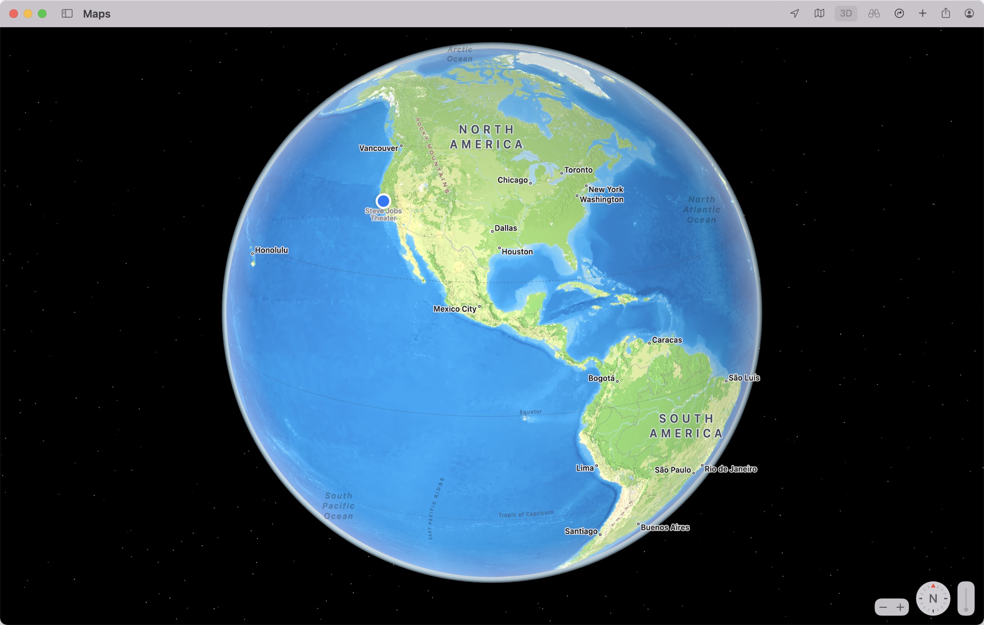
If you zoom all the way out in the Maps app you can get to an interactive globe view, which is new to Maps. You can rotate the globe and drill down into different areas around the world, and Apple has greatly enhanced the details you see for mountain ranges, deserts, forests, and oceans.
maps-monterey-terrain.jpg

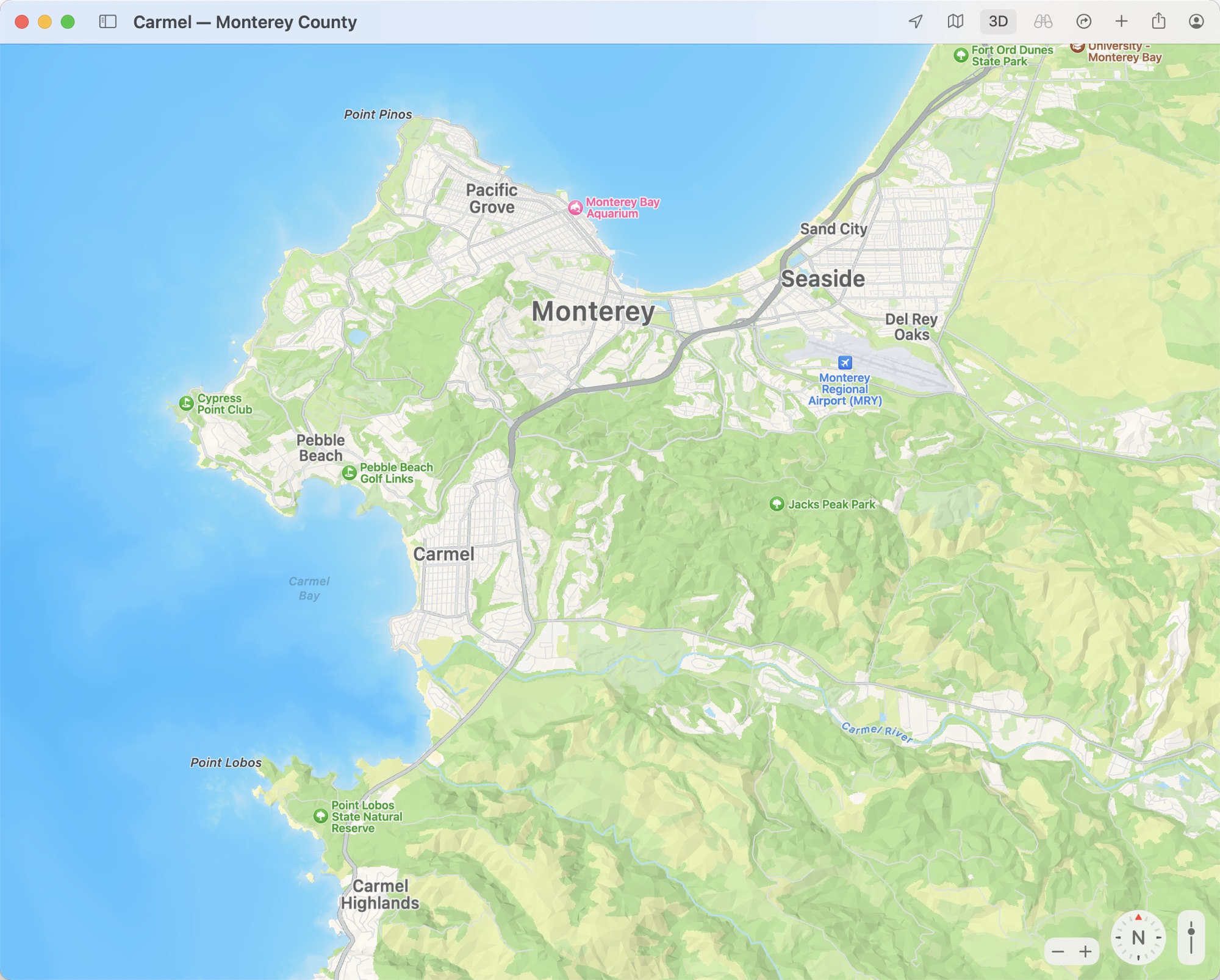
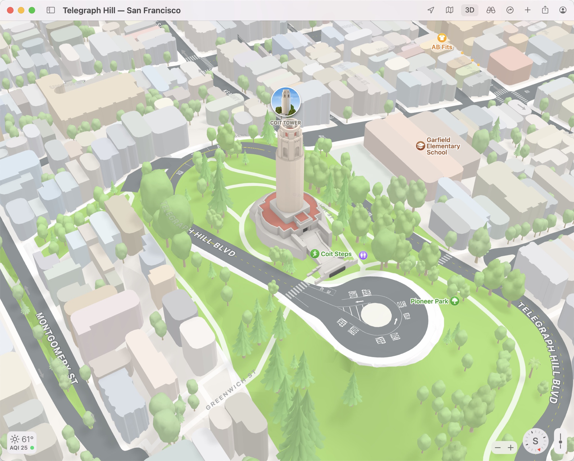
In cities that include San Francisco, Los Angeles, New York, and London, Apple has added tons more detail for elevation, roads, trees, and buildings, with these features rendered in 3D. In San Francisco, for example, you can see notable landmarks like the Golden Gate Bridge and Coit Tower rendered in 3D.
maps-monterey-3d-view-coit-tower.jpg

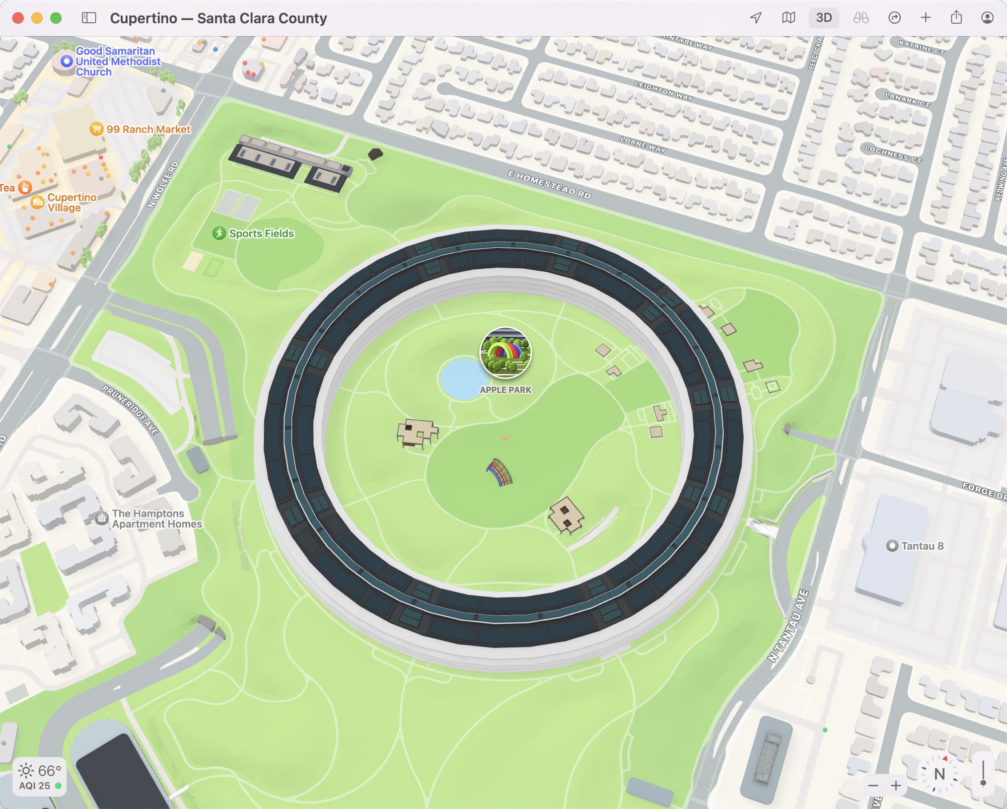
Apple's own Infinite Loop and Apple Park campuses are also rendered in this new detailed 3D look so you can get a closer bird's eye view of the iconic ring-shaped building. It's likely Apple will add this more detailed view to additional cities in the coming months as it has done with other Maps features like Look Around.
maps-3d-view-apple-park.jpg

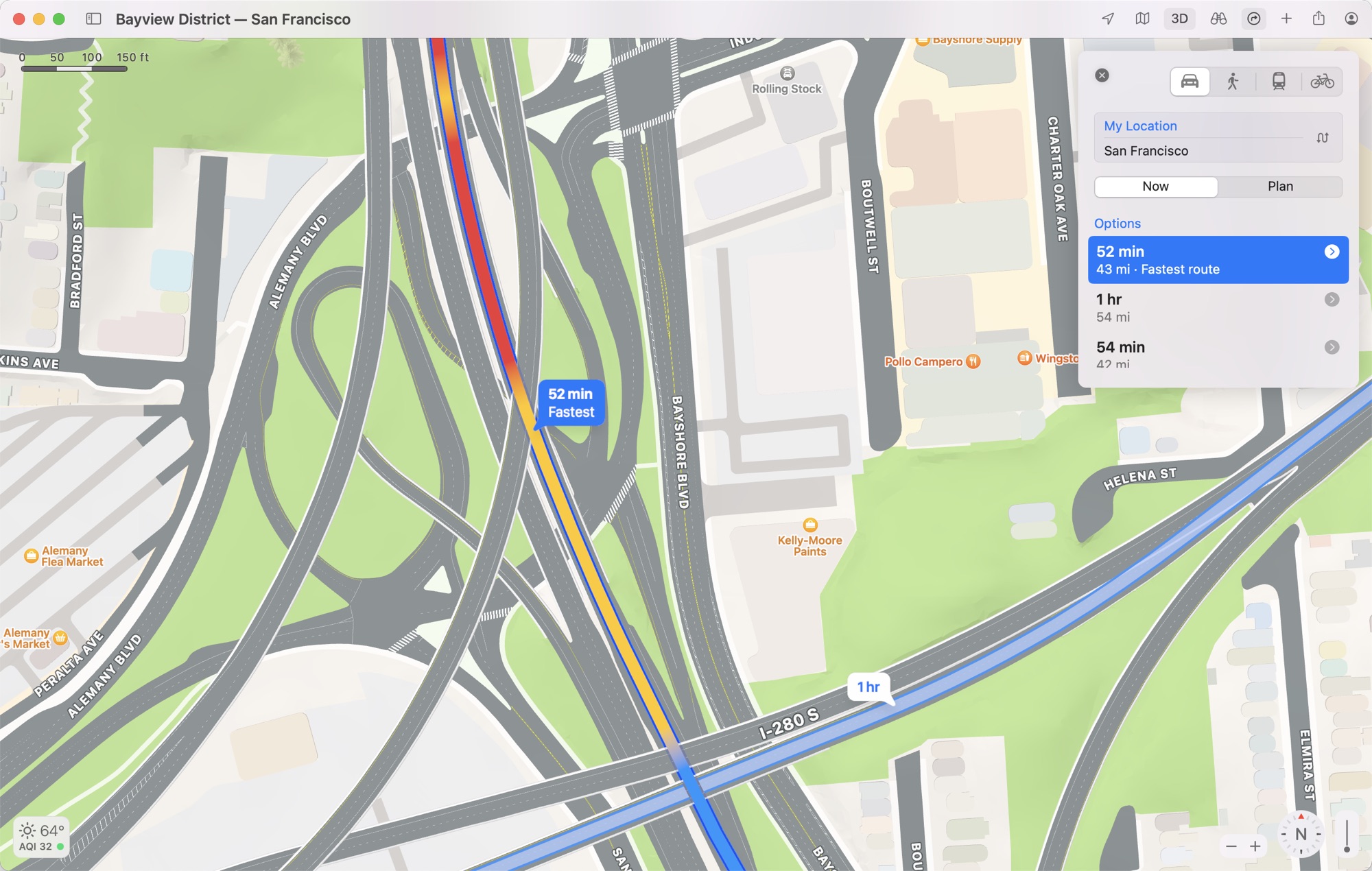
An updated driving map provides additional detail on traffic and hazards that might affect your drive, and roads are much more detailed with clearly delineated turn lanes, bike lanes, bus lanes, medians, crosswalks, and more to give you a better overview of your route.
maps-monterey-road-view.jpg

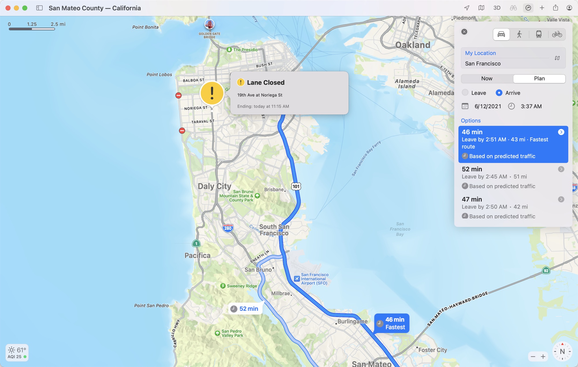
You can also plan trips in advance to see future estimated traffic conditions with Maps providing recommended Leave By times.
maps-monterey-estimated.jpg

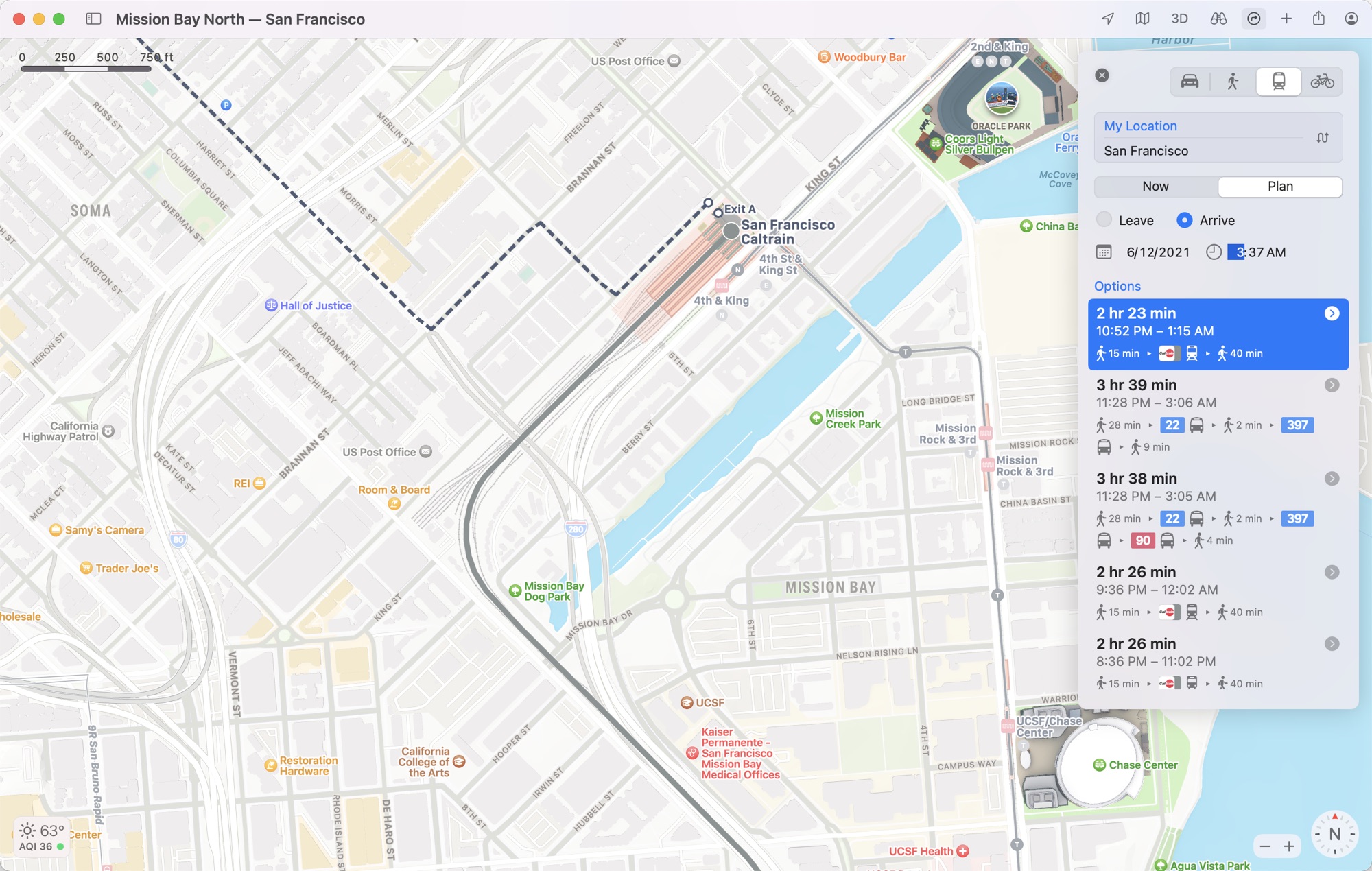
For transit users, the transit map has been updated for the city experience and it displays key bus routes, plus there's one-click access to a list of all departures nearby and an option to pin favorite lines.
maps-monterey-transit.jpg

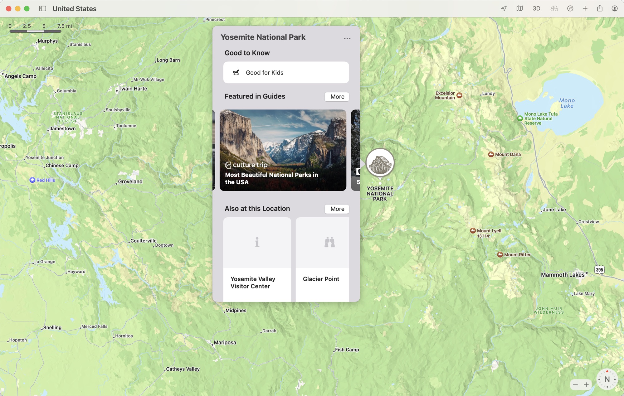
Place cards for businesses, landmarks, restaurants, and more have been updated with a new design, with Apple providing details about nearby places, other spots at the same location, Guide availability, and more. Apple is still using Yelp to pull in information like reviews.
maps-monterey-place-cards.jpg

Other new features in macOS Monterey include a Guides Home for finding new editorially curated guides, improved search with filters that drill down into the results, and a new user profile where Maps users can manage their settings.

These features are available to developers who have macOS Monterey installed at the current time, with Apple planning to release a public beta in July. macOS Monterey will be available to the public this fall.

Article Link: Maps in macOS Monterey: Interactive Globe, Detailed Terrain, 3D Landmarks, Updated Driving Features and More
 

Khedron

Suspended
Sep 27, 2013
2,561
5,755
Those renderings are very nice. Detailed and realistic but without the noise of just being a photo.

Unfortunately Apple’s track record suggests that 3 years from now the list of supported cities will barely extend past the famous few they always use in PR.

Look Around is just taking panoramas with a GPS signal. Barely any effort required and Apple still can’t be bothered for most places. No chance they create these bespoke 3D buildings for a meaningful number of cities.
 

allenhj

macrumors newbie
Oct 17, 2014
2
1
I'm not able to run the developer beta so I would love to see an article that shows all the 3D/colorized models in SF but haven't seen anything like that yet. I wonder if the new 3D models are only rolled out for SF in the beta or if they're in the other cities mentioned in the Keynote as getting the new treatment, like NYC or Philly
 
  • Like
Reactions: Redsep

visualseed

macrumors 6502a
Dec 16, 2020
902
1,831
I misread "landmarks" and "landmines" for a brief second and now I think that would be a hell of a good idea.
 
  • Like
Reactions: applesque

mordac

macrumors newbie
Oct 30, 2014
8
38
UK
Have they fixed the stars in the globe view yet? I logged it as a bug years ago - they should be able to do a better star field than some crappy windows screensaver. It would be awesome if they could at least get the Milky Way and a few recognisable constellations...
 

Killbill2

macrumors member
Oct 24, 2017
64
161
It looks great and all, but what do maps of regions that Apple haven't finished surveying yet look like?
Like crap… still don’t even have imagery over 3D structures or even two year old demolished structures! For many of us this has been vaporware for years… yet Apple loves to rub our noses in what we’ve been excluded from. This feels so much like a concept video from Microsoft or Google or from a Detroit auto company. Circle J from the Apple advertising company.
 

mazz0

macrumors 68040
Mar 23, 2011
3,132
3,579
Leeds, UK
The 3D terrain stops when you zoom in on my area. I wonder if that’s because they use a different dataset for close up stuff, which they don’t have yet, or if there’s some manual work required for each area.
 

mazz0

macrumors 68040
Mar 23, 2011
3,132
3,579
Leeds, UK
Have they fixed the stars in the globe view yet? I logged it as a bug years ago - they should be able to do a better star field than some crappy windows screensaver. It would be awesome if they could at least get the Milky Way and a few recognisable constellations...
Years ago? The globe view’s brand new.
 

baryon

macrumors 68040
Oct 3, 2009
3,879
2,940
Sure but does it still completely ignore your current location when searching for addresses, and displays 10 billion partial matches from China to Russia through planets within the observable universe? Because that's the reason I still refuse to give Apple Maps a chance.

I think that before spending any effort adding fancy new features, they should first fix the biggest issue: it cannot freaking resolve addresses and it can't find a damn thing, all of which Google Maps can do without fail every time, and could do it 12 years ago just as well.
 

mazz0

macrumors 68040
Mar 23, 2011
3,132
3,579
Leeds, UK
If you go to Satellite mode with 3D activated and zoom out, you get a globe in iOS 14 and macOS Big Sur (I think this is also available in earlier versions).
Well golly gosh, I had no idea! I don’t have a non-iOS 15 device to test on now* - it doesn’t work in non-satallie view then?

*and 3D doesn’t appear to work on my Mac at all, probably cos it’s an illegally upgraded 2011 iMac. Speaking of which, I wonder if I’ll be able to get Monterey working on it…
 
  • Like
Reactions: applesque

TGM85

macrumors 6502
Aug 29, 2005
268
754
Those renderings are very nice. Detailed and realistic but without the noise of just being a photo.

Unfortunately Apple’s track record suggests that 3 years from now the list of supported cities will barely extend past the famous few they always use in PR.

Look Around is just taking panoramas with a GPS signal. Barely any effort required and Apple still can’t be bothered for most places. No chance they create these bespoke 3D buildings for a meaningful number of cities.
Maybe that where the 16 neural engine cores of the M1 come in? The bespoke 3D buildings are procedurally generated on the fly, based on map and photograph data? Just guessing...
 

Crestofcourage

macrumors newbie
Mar 29, 2017
3
6
Yeah this is cool and all but i would take helpful useful features over all this flash. How about
1. Being able to search for a specific place while driving not just pre determined points.
2. music playback on maps integration. (like google)
3. multistop directions

Apple can easily do all of this but instead we get, good looking map. We need Good functioning maps not this.
 

danielagos

macrumors member
Mar 13, 2015
52
80
Well golly gosh, I had no idea! I don’t have a non-iOS 15 device to test on now* - it doesn’t work in non-satallie view then?

*and 3D doesn’t appear to work on my Mac at all, probably cos it’s an illegally upgraded 2011 iMac. Speaking of which, I wonder if I’ll be able to get Monterey working on it…
In iOS 14 and Big Sur, the globe is only available with satellite view, yes. The controls are a bit finicky, though, sometimes the 3D toggle is disabled (but if you go to a 3D-enabled city and keep zooming out, you'll get the globe).
 
  • Like
Reactions: User 6502

w5jck

Suspended
Nov 9, 2013
1,517
1,935
Ever since they started displaying so many green areas on the maps they have become very difficult to read. We should be able to toggle vegetation on or off. I prefer it off so I can see the roads and text better. Also, there is now so much green that I can no longer quickly locate parks! Parks used to stand out, but now they blend in.
 
Register on MacRumors! This sidebar will go away, and you'll see fewer ads.